Latest Mesoscale Discussion — Threat for Strong Tornadoes Continue
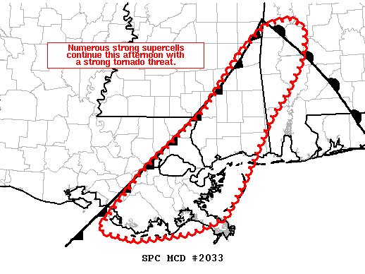
SUMMARY… Numerous strong supercells continue this afternoon with a threat for strong tornadoes.
DISCUSSION… Numerous supercells developed this afternoon with only a few confirmed tornadoes. However, these storms have congealed into a line of 5-6 dominant supercells extending from Clarke County, Mississippi to southwest of New Orleans. This storm evolution is seemingly more favorable for low-level updraft circulations as TDSs have recently been observed in Clarke County, Mississippi and south of Lake Pontchartrain from similar strength rotational velocity as the numerous supercells which lacked a clear TDS in the prior 1 to 2 hours. Therefore, as heating reaches its diurnal maximum, low-level flow continues to strengthen in association with the deepening meso-low, and the low-level jet strengthens to 60+ knots per LIX VWP, storms may be entering the period of greatest tornado potential.
The most favorable environment is currently near New Orleans where STP values of 4 to 5 exist with a couple supercells approaching from the Southwest. Therefore, portions of southeast Louisiana, including the New Orleans metro area may have the greatest chance for strong tornadoes over the next 1 to 2 hours.
Category: Alabama's Weather, ALL POSTS, Severe Weather


