A Brief Update on Our Weather Situation at 2 pm
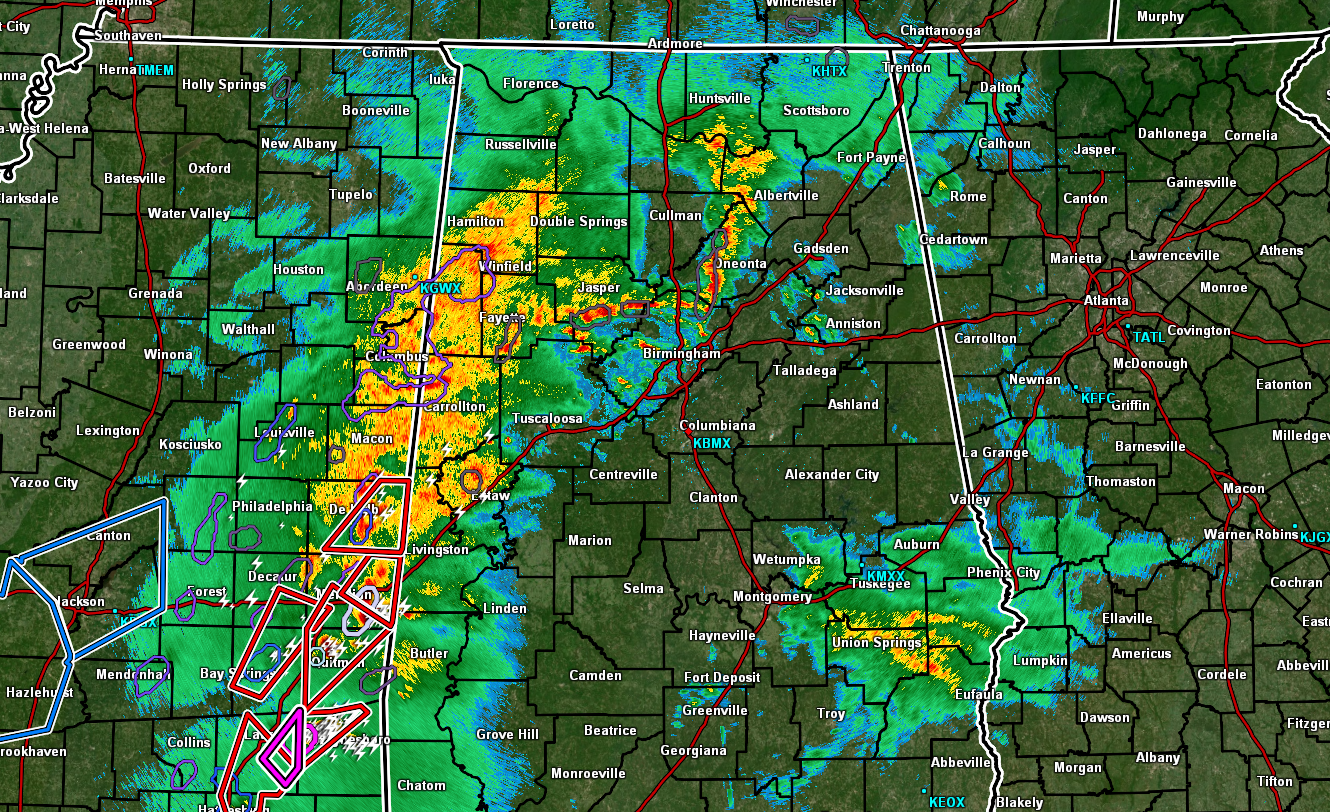
While moderate to heavy rain continues to fall over an already-soaked portion of North/Central Alabama, southeastern Mississippi is up to their armpits in Tornado Warnings, especially along the I-59 corridor. At this point, no warnings are in effect for anywhere in our area, but that may change within the next hour or so. Here is a rundown of watches and outlooks in effect for our area.
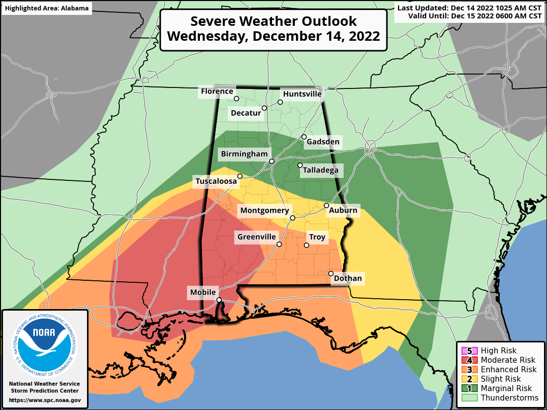
A Moderate Risk for severe storms continues along and south of a line from Livingston (Sumter Co.) to Linden (Marengo Co.).
An Enhanced Risk continues along and south of a line from Eutaw (Greene Co.) to Selma (Dallas Co.) to Hayneville (Lowndes Co.) to just north of Clayton (Barbour Co.).
A Slight Risk continues along and south of a line from Reform (Pickens Co.) to Jemison (Chilton Co.) to Opelika (Lee Co.).
A Marginal Risk continues for locations along and south of a line from just south of Hamilton (Marion Co.) to Blountsville (Blount Co.) to just north of Jacksonville (Calhoun Co.).
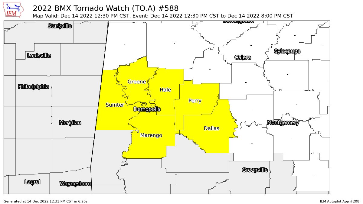
A PDS TORNADO WATCH continues until 8 pm tonight for Dallas, Greene, Hale, Marengo, Perry, Sumter counties in Central Alabama. This is a particularly dangerous situation as numerous tornadoes are expected with a few intense tornadoes likely, scattered damaging wind gusts to 70 mph possible, and isolated large hail events to 1.5 inches in diameter are also possible.
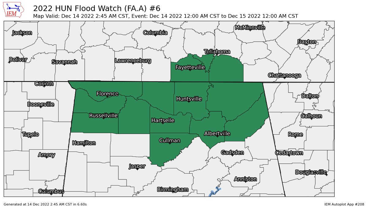
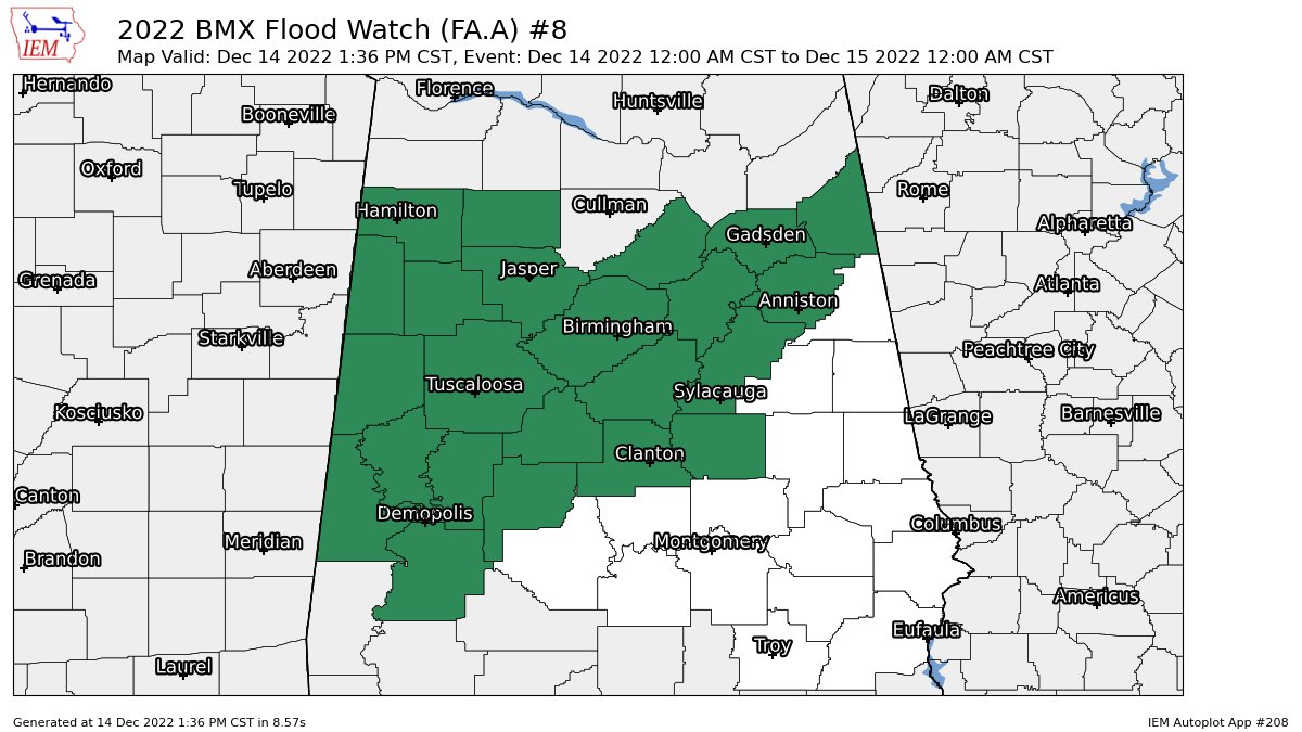
A FLOOD WATCH continues until midnight tonight for Bibb, Blount, Calhoun, Cherokee, Chilton, Coosa, Etowah, Fayette, Greene, Hale, Jefferson, Lamar, Marengo, Marion, Perry, Pickens, Shelby, St. Clair, Sumter, Talladega, Tuscaloosa, Walker, Winston counties in Central Alabama, and for Colbert, Cullman, DeKalb, Franklin, Jackson, Lauderdale, Lawrence, Limestone, Madison, Marshall, Morgan counties in North Alabama.
As mentioned in the earlier Mesoscale Discussion, the threat for strong, long-track tornadoes will continue for at least the next few hours across eastern Louisiana and southern Mississippi, eventually reaching southwest Alabama later this afternoon and into early this evening.
Category: Alabama's Weather, ALL POSTS, Severe Weather
About the Author (Author Profile)
Scott Martin is an operational meteorologist, professional graphic artist, musician, husband, and father. Not only is Scott a member of the National Weather Association, but he is also the Central Alabama Chapter of the NWA president. Scott is also the co-founder of Racecast Weather, which provides forecasts for many racing series across the USA. He also supplies forecasts for the BassMaster Elite Series events including the BassMaster Classic.Subscribe
If you enjoyed this article, subscribe to receive more just like it.


