Midday Nowcast: Clouds Remain; Midweek Storm Threat
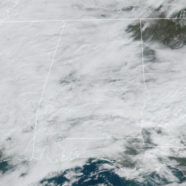
Not much change in the forecast today and tomorrow as the sky is generally cloudy and temperatures are in the 60s for most locations. There are few showers on the radar today, but the better the chance for these remain over the southern portions of the state. Tonight, expect lows in the 50s, and likely areas of fog.
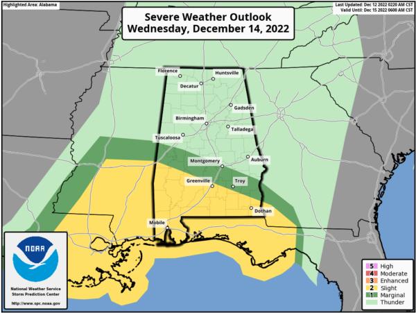
WEDNESDAY FRONT: A dynamic storm system will bring the risk of heavy rain and strong thunderstorms to Alabama Wednesday. The SPC has defined a “slight risk” (level 2/5) for areas south of a line from York to Greenville to Abbeville, and a “marginal risk” as far north as Eutaw, Montgomery, and Eufaula.
Thunderstorms over the southern third of the state Wednesday will likely produce damaging wind gusts, and there is some tornado potential as veering/increasing flow with height anticipated across the area will be favorable for supporting evolution of rotating updrafts/supercells. As of now, the lack of surface based instability means that storms over the northern half of Alabama will likely remain below severe limits, but heavy rain is possible statewide, with amounts of 2-3 inches very possible. Some flooding issues could develop. Much of the day looks rather wet for Alabama, and for southern sections of the state, the core severe weather threat Wednesday will come from about 2PM-10PM.
As the front swings through the state, the rain and storms will end very early Thursday morning, followed by a clearing sky along with temperatures holding in the 50s with a cool north wind.
FRIDAY AND THE WEEKEND: Friday and Saturday will be dry and much colder. The high Friday will be 50s, and only in the mid and upper 40s Saturday. Temperatures go below freezing Saturday morning Most of the state will stay dry Sunday, but a feature will work along the Gulf Coast this weekend will bring clouds and some rain along the Gulf Coast. Highs Sunday will be in the 40s over North Alabama, with 50s for the southern counties of the state.
NEXT WEEK: Forecast confidence is low concerning specific weather events with a complex pattern in place; some rain is possible early in the week based on the reliable European global model. It is likely that temperatures through the week will remain below average as a cold pattern develops for much of the continuous U.S. There is potential for a cross-polar flow to develop next week, which will keep temperatures here below average through Christmas.
BEACH FORECAST CENTER: Get the latest weather and rip current forecasts for the beaches from Fort Morgan to Panama City on our Beach Forecast Center page. There, you can select the forecast of the region that you are interested in visiting.
WORLD TEMPERATURE EXTREMES: Over the last 24 hours, the highest observation outside the U.S. was 115.0F at Roebourne, Australia. The lowest observation was -77.8F at Ojmjakon, Russia.
CONTIGUOUS TEMPERATURE EXTREMES: Over the last 24 hours, the highest observation was 88F at Linn, TX. The lowest observation was -1F at Clayton Lake, ME.
Category: Alabama's Weather, ALL POSTS


