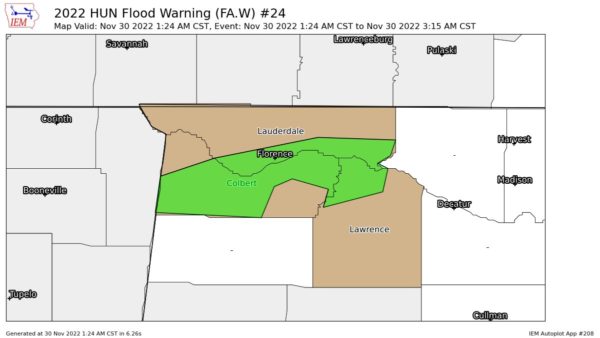
Areal Flood Warning — Parts of Colbert, Lauderdale, Lawrence Co. Until 3:15 am
…FLOOD WARNING IN EFFECT UNTIL 315 AM CST EARLY THIS MORNING…
…REPLACES FLASH FLOOD WARNING…
* WHAT…Flooding caused by excessive rainfall is expected.
* WHERE…A portion of northwest Alabama, including the following
counties, Colbert, Lauderdale and Lawrence.
* WHEN…Until 315 AM CST.
* IMPACTS…Flooding of rivers, creeks, streams, and other low-lying
and flood-prone locations is imminent or occurring.
* ADDITIONAL DETAILS…
– At 123 AM CST, Doppler radar indicated heavy rain due to
thunderstorms. Flooding is ongoing or expected to begin
shortly in the warned area. Between 2 and 4 inches of rain
have fallen.
– Additional rainfall amounts up to 0.5 inches are possible in
the warned area.
– Some locations that will experience flooding include…
Florence, Muscle Shoals, Sheffield, Tuscumbia, Rogersville,
Killen, Town Creek, Cherokee, Leighton, Courtland, St.
Florian, North Courtland, Colbert Heights, Northwest Alabama
Regional Airport, Pride Landing, New Bethel, Ford City, Posey
Loop, Crooked Oak and Red Rock.
– http://www.weather.gov/safety/flood
PRECAUTIONARY/PREPAREDNESS ACTIONS…
Turn around, don’t drown when encountering flooded roads. Most flood
deaths occur in vehicles.
Category: Alabama's Weather, ALL POSTS


