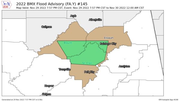
Areal Flood Advisory — Parts of Blount, Etowah, St. Clair Co. Until 12 am
…FLOOD ADVISORY IN EFFECT UNTIL MIDNIGHT CST TONIGHT…
* WHAT…Urban and small stream flooding caused by excessive
rainfall is expected.
* WHERE…A portion of central Alabama, including the following
counties, Blount, Etowah and St. Clair.
* WHEN…Until midnight CST.
* IMPACTS…Minor flooding in low-lying and poor drainage areas.
* ADDITIONAL DETAILS…
– At 757 PM CST, Doppler radar indicated heavy rain due to
thunderstorms. This will cause urban and small stream
flooding.
– Some locations that will experience flooding include…
Gadsden, Rainbow City, Oneonta, Attalla, Springville,
Cleveland, Margaret, Argo, Ashville, Ragland, Locust Fork,
Steele, Allgood, Fairview, Nectar, Rosa, Inland Lake, Neely
Henry Lake, Logan Martin Lake and Southside.
PRECAUTIONARY/PREPAREDNESS ACTIONS…
Turn around, don’t drown when encountering flooded roads. Most flood
deaths occur in vehicles.
Be especially cautious at night when it is harder to recognize the
dangers of flooding.
Category: Alabama's Weather, ALL POSTS, Severe Weather


