PDS Tornado Watch Expected for Parts of Louisiana, Arkansas, and Mississippi by 1 p.m.
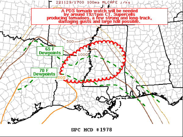
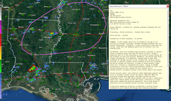
The SPC has issued a Mesoscale Discussion to our west indicating that a tornado watch will be required by 1 p.m. CDT for parts of extreme Southeast Arkansas, Central Mississippi, and northeastern Louisiana.
It will be a PDS or Particularly Dangerous Situation Tornado Watch. Those are very rare in November. There has only been one other one PDS November Tornado Watch, and it occurred in 2013.
The main factors at play include:
…A rapid increase in Gulf moisture has brought 65 degree dewpoints across much of Louisiana, the southern third of Mississippi, and Southwest Alabama. This process will continue to occur into the afternoon and overnight
…Really rich dewpoints over 70 degrees are inland over southern Louisiana, coastal Mississippi, and just off shore of the Alabama coast.
…Steep midlevel lapse rates are overspreading the area and are increasing the CAPE.
…Breaks in the cloud cover over the area are increasing heating and destabilization of the atmosphere.
We now have a tornado warning for Evangeline and Allen parishes in southern Louisiana. There is a supercell storm between Basile and Oakdale moving northeast in the general direction of Bunkie. Mixed layer CAPE in the vicinity of this storm is already above 2,200 joules/kg. 0-1 km store relative helicity is around 161 m2/s2. So there is sufficient instability and shear for tornadoes.
This activity will move into western Alabama later this evening, when instability should be waning, but the severe threat does extend into our state. Make sure you know where you will go if a tornado warning is issued for any place you might be located tonight and have multiple ways to receive warnings, especially ways that will wake you up.
Category: Alabama's Weather, Severe Weather


