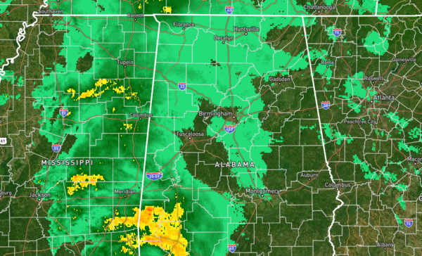
Early Evening Look at Our Weather… Rain Increasing in the West
For much of Central Alabama, especially in the central and eastern parts, rainfall may be very light or evaporating before reaching the ground where the echoes are showing up on radar. However, we are now seeing heavier activity starting to increase from the southwest and along the Alabama/Mississippi state line. For now, no rain is falling at BDS in Tuscaloosa, but it is not very far off at all. We may actually get away with only a few light raindrops before the end of the game, but heavier rain will move in soon after.
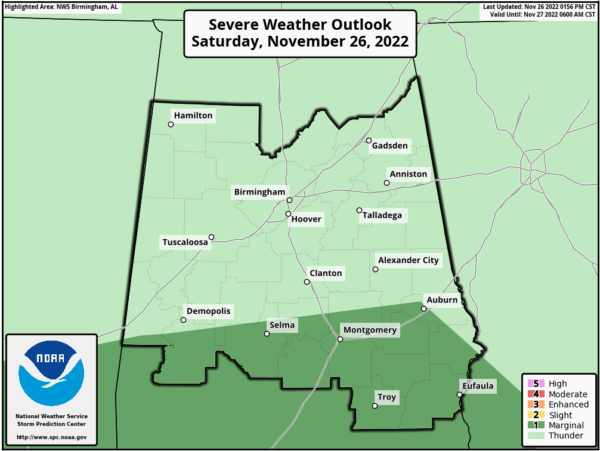
No change in the Severe Weather Outlook as a Marginal Risk continues for locations along and south of a line from Cuba (Sumter Co.) to Deatsville (Elmore Co.) to just north of Auburn (Lee Co.) to just south of Fort Mitchell (Russell Co.). The rest of Central Alabama has just the general risk of thunderstorms with no severe weather likely.
Timing for the threat of strong to severe storms over the southern parts of the area will be moved up sooner from now through 2 am Sunday from west to east. Isolated damaging wind gusts are the main threat, but a brief spin-up tornado or two cannot be ruled out.
For the central and northern parts of Central Alabama, we’ll have showers with maybe a few rumbles of thunder, but no stronger to severe storms are expected. We will have to remember that winds will be increasing this evening as the pressure gradient will be tightening, and a low-level jet will be moving across the area.
A Wind Advisory goes into effect at 6 pm for all of Central Alabama and all of North Alabama, and set to expire at 6 am Sunday. Gusts may reach up to 40 mph at times, so be sure those outdoor decorations have been secured, along with any other unsecured objects.
Category: Alabama's Weather, ALL POSTS, Severe Weather


