Scattered Strong Storms Through The Evening Hours
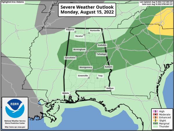
RADAR CHECK: Showers and storms are forming rapidly in scattered locations over the northern half of Alabama this afternoon. SPC maintains a “marginal risk” (level 1/5) of severe thunderstorms through the evening hours… some strong wind gusts are possible. Of course, all summer storms produce lots of lightning and heavy rain.
Away from the storms, it is a hot, humid day with temperatures in the low to mid 90s. This will be the hottest day of the week.
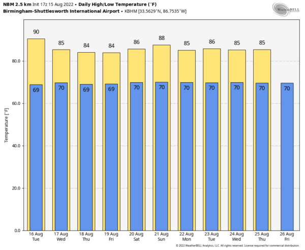
REST OF THE WEEK: Showers should be few and far between across Alabama tomorrow, but a few strong storms could form over the southern counties of the state, where SPC is keeping a “marginal risk” (level 1/5) in place. The high tomorrow will be close to 90 degrees in most places. Then, showers and storms will increase statewide Wednesday through Friday as moisture levels rise, and the air becomes more unstable. Of course, on any given day it won’t rain everywhere, and it won’t rain all day. But, any one place stands a 70-80 percent chance of seeing some rain at some point during the latter half of the week. Heat levels will come down with highs mostly in the mid 80s, below average for mid-August in Alabama.
THE ALABAMA WEEKEND: Not much change; the sky will be occasionally cloudy Saturday and Sunday with scattered to numerous showers and thunderstorms both days, most active from noon to midnight. Highs will be in the mid to upper 80s.
NEXT WEEK: Expect a mix of sun and clouds each day with “scattered, mostly afternoon and evening showers and thunderstorms” through the week. Highs will remain below 90 degrees on most days… See the daily Weather Briefing video for maps, graphics, and more details.
TROPICS: All is amazingly quiet across the vast Atlantic basin this afternoon, and tropical storm formation is not expected through the week. We are now in the peak of the hurricane season.
ON THIS DATE IN 1983: Hurricane Alicia formed on this day and was the costliest tropical cyclone in the Atlantic since Hurricane Agnes in 1972. It struck Galveston and Houston, Texas directly, causing $2.6 billion in damage and killing 21 people. This storm was the worst Texas hurricane since Hurricane Carla in 1961. Also, Alicia was the first billion-dollar tropical cyclone in Texas history.
BEACH FORECAST: Click here to see the AlabamaWx Beach Forecast Center page.
Look for the next Weather Briefing video here by 6:00 a.m. tomorrow…
Category: Alabama's Weather, ALL POSTS, Weather Xtreme Videos


