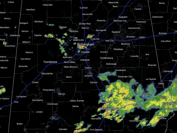
Midday Nowcast: Some Showers and Storms
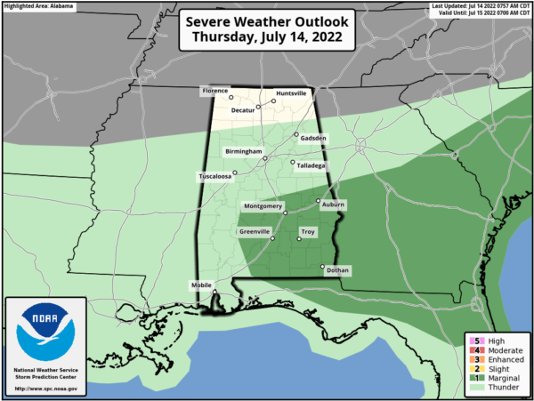
Some showers and storms are developing across North/Central Alabama, but the main storm threat continues to be across South and Central Alabama where widespread showers and storms are ongoing. The SPC has a “marginal risk” (level 1/5) for all of Southeast Alabama as a storms could produce damaging wind gusts, and some hail.
And, of course, all summer storms pack lots of lightning and tropical downpours, that can cause areas of flash flooding, which been an issue this morning around the Montgomery, Wetumpka, and Auburn areas. For the rest of the state, we are seeing more sun than clouds, which is allowing temperatures to climb into the upper 80s and lower 90s, and again some showers and storms are ongoing at the midday hours around the Birmingham Metro.
FRIDAY AND THE WEEKEND: Lower rain chances for tomorrow and the weekend as we expect partly to mostly sunny days, fair nights, and a few showers and storms around during the afternoon and evening hours. Afternoon highs should be in the low 90s and rain chances in the 20-30% range.
NEXT WEEK: Southwest flow looks to develop and that will allow for scattered showers and storms on a daily basis, rain chance look to be in the 40-50% range. Highs should range from the low to mid 90s with a mix of sun and clouds each day.
THE TROPICS: The Atlantic Basin is quiet for now.
BEACH FORECAST CENTER: Get the latest weather and rip current forecasts for the beaches from Fort Morgan to Panama City on our Beach Forecast Center page. There, you can select the forecast of the region that you are interested in visiting.
WORLD TEMPERATURE EXTREMES: Over the last 24 hours, the highest observation outside the U.S. was 118.8F at Omidieh, Iran. The lowest observation was -104.1F at Dome C, Antarctica.
CONTIGUOUS TEMPERATURE EXTREMES: Over the last 24 hours, the highest observation was 123F at Death Valley, CA. The lowest observation was 27F at Peter Sinks, UT.
Category: Alabama's Weather, ALL POSTS


