A Pretty Standard Wash and Repeat Summertime Forecast
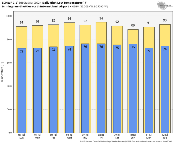
Today will be another typical summer day across Central Alabama as it will be hot and humid with a good chance for scattered to numerous showers and storms during the afternoon and early evening hours. Highs will be in the upper 80s to the lower 90s.
Monday, Independence Day, will be a near repeat of today. Hot, humid, and scattered to numerous showers and storms possible during the afternoon and early evening hours. Highs will be in the upper 80s to the lower 90s.
While the forecast doesn’t change that much at all for the rest of the week, temperatures will be getting hotter. Isolated to scattered afternoon showers and storms possible on Tuesday, with highs in the lower to mid 90s. Same story for Wednesday, with highs in the lower to mid 90s. And again on Thursday, with highs in the lower to mid 90s. The activity looks to be more isolated on Friday afternoon, as highs will be in the lower to mid 90s.
Next weekend looks to be pretty similar as well. Isolated to scattered afternoon showers and storms on both days, with highs in the upper 80s to the lower 90s on Saturday, and in the upper 80s to the lower 90s on Sunday.
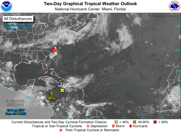
And taking a look at the tropics, Colin dissipated over the North Carolina coast earlier this morning. We also have a tropical wave over the Central Caribbean Sea that is moving westward into a harsh environment and is not expected to develop any further. The rest of the Atlantic Basin is quiet for now.
Category: Alabama's Weather, ALL POSTS, Tropical, Weather Xtreme Videos


