Midday Nowcast: Not as Stormy Today
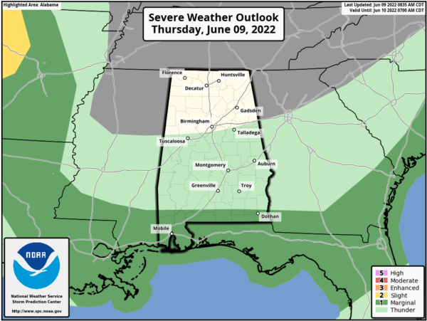
Warm and muggy across the state, but not as stormy today. The boundary responsible for this week’s rain and storms has dropped into South Alabama and that is where the better chance of strong storms is today. The SPC has a “marginal risk” of severe thunderstorms due to the potential for some hail and strong gusty wind for far South Alabama and Northwest Florida.
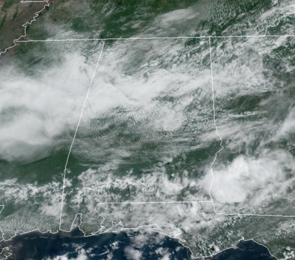
For Central Alabama, we are seeing a mix of sun and clouds and temperatures in the mid to upper 80s. The radar is quiet for now, and should remain that way for most locations with rain chances much lower compared to recent days, but a few afternoon showers/storms remain possible.
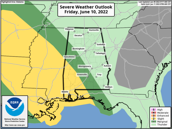
FOR FRIDAY: The boundary across South Alabama will act like a train track for a MCS (cluster of storms) that develops in the Plains today and will move towards Alabama tomorrow. Rain chances for Alabama are higher tomorrow, and there will be some stronger storms, but these should be west and south of the area, where the SPC has the risk for severe storms outlined; damaging winds and hail are main threat. For the rest of the state, we should see some showers and storms with highs in the mid to upper 80s.
THE ALABAMA WEEKEND: Showers and storms will decrease in coverage for the weekend, but some will remain in the forecast both days. For Saturday and Sunday we are forecasting a good supply of sunshine and only isolated showers and storms. The high Saturday will be in the mid to upper 80s and lower 90s Sunday.
NEXT WEEK: An upper ridge is forecast to strengthen, with potential for highs in the mid 90s by the middle of next week. Some risk of scattered storms during the afternoon and evening hours, but much of the week for now looks dry.
IN THE TROPICS: The Atlantic Basin, all is quiet, with no tropical cyclone development expected in through the weekend.
BEACH FORECAST CENTER: Get the latest weather and rip current forecasts for the beaches from Fort Morgan to Panama City on our Beach Forecast Center page. There, you can select the forecast of the region that you are interested in visiting.
WORLD TEMPERATURE EXTREMES: Over the last 24 hours, the highest observation outside the U.S. was 125.4F at Jahra, Kuwait. The lowest observation was -76.4F at Dome A, Antarctica.
CONTIGUOUS TEMPERATURE EXTREMES: Over the last 24 hours, the highest observation was 116F at Death Valley, TX. The lowest observation was 30F at Peter Sinks, UT.
Category: Alabama's Weather, ALL POSTS


