Midday Nowcast: More Rain and Storms on the Way
The weak frontal boundary continues to slowly drop through the state and remains the focal point for showers and storms across Alabama. When it is not raining, the days are featuring a mix of sun and clouds, very humid conditions, and temperatures are ranging from the low 80 to the low 90s.
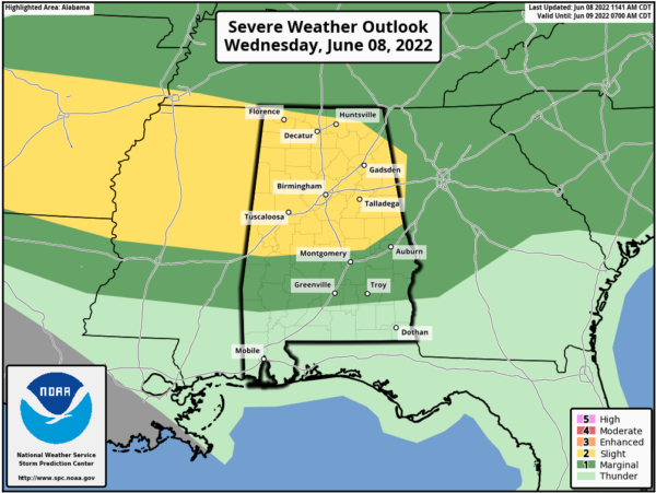
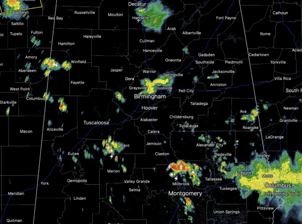
However, when the rain and storms develop, they come with voracity, producing lots of lightning, gusty winds, hail, and torrential tropical downpours which have been causing significant flash flooding issues across Alabama the last 24 hours. Some of these storms could reach severe limits and all of North and Central Alabama remains a the level 2 of 5 “slight risk” of severe storms this afternoon and evening. Storms are developing west of Alabama and these storms will roll into Alabama later today possibly producing hail and damaging wind gusts.
As we wait on these storms to the west, there is plenty of instability available and we are watching more rain and storms develop at the midday hour, in areas which have already received way too much rain already this morning.
Remain weather aware this afternoon, evening, and into the overnight for more strong storms and possible flash flooding. A Flood Watch is in effect for much of Central Alabama…DO NOT DRIVE THROUGH FLOODWATERS…TURN AROUND DON’t DROWN!!!
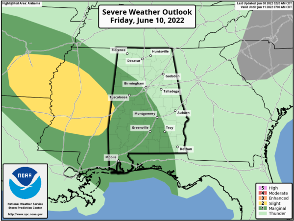
Tomorrow the front drops to the south and the rain and storms should be closer to the Gulf Coast. However, on Friday, another boundary drops into the state and will once again bring the threat for strong to severe storms and heavy rainfall to Alabama
THE ALABAMA WEEKEND: Showers and storms will thin out as the Friday front drops towards the Gulf Coast over the weekend. For Saturday and Sunday we are forecasting a good supply of sunshine and only isolated showers and storms both days. The high Saturday will be in the mid 80s and closer to 90° Sunday,
NEXT WEEK: An upper ridge is forecast to strengthen, with potential for highs in the mid 90s by the middle of next week. Some risk of scattered storms during the afternoon and evening hours, but much of the week for now looks dry.
IN THE TROPICS: The Atlantic Basin, all is quiet, with no tropical cyclone development expected in through the weekend.
BEACH FORECAST CENTER: Get the latest weather and rip current forecasts for the beaches from Fort Morgan to Panama City on our Beach Forecast Center page. There, you can select the forecast of the region that you are interested in visiting.
WORLD TEMPERATURE EXTREMES: Over the last 24 hours, the highest observation outside the U.S. was 126.9F at Jahra, Kuwait. The lowest observation was -89.5F at Vostok, Antarctica.
CONTIGUOUS TEMPERATURE EXTREMES: Over the last 24 hours, the highest observation was 117F at Rio Grande Village, TX. The lowest observation was 24F at Albany, MT.
Category: Alabama's Weather, ALL POSTS


