Mostly Dry Today; Rain Chances Return Over The Weekend
ANOTHER HOT MAY DAY AHEAD: Today will be another hot May day across Alabama with lots of hazy sunshine; temperatures will reach the low 90s in many areas this afternoon. A few isolated showers or storms could pop up during the heat of the day over the southern half of the state, but the chance of any one location seeing rain is fairly low.
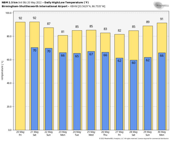
THE ALABAMA WEEKEND: The upper ridge over the region will break down, and moisture levels will rise. For tomorrow, we are forecasting a mix of sun and clouds with a few developing showers and storms in random, scattered locations by afternoon. The better coverage will be over South Alabama, and the high will be in the 86-90 degree range. Showers and thunderstorms will be more numerous statewide Sunday as a weak surface front approaches. It won’t rain all day Sunday, but periods of rain are likely along with the potential for a few strong thunderstorms. With only a limited amount of sun the high Sunday will be close to 80 degrees.
NEXT WEEK: Rain chances will remain somewhat elevated through the week as a moist, unstable airmass remains in place. Each day we expect scattered to numerous showers and storms, most active during the afternoon and evening hours. Global models suggest the weather could begin to trend drier by Friday (May 27), as the holiday weekend begins. Highs will be mostly in the 80s through the week… See the Weather Xtreme video for maps, graphics, and more details.
GETTING DRY: Birmingham has received only 0.05″ of rain in the last 18 days. The last day with over one inch of rain was back on April 16, when the total was 2.59″. The surplus for the year is down to 4.92″.
FOOTBALL WEATHER: The Birmingham Stallions host the Michigan Panthers tomorrow evening (6:30p CT kickoff) at Protective Stadium; the weather will be warm and humid with an outside risk of a passing shower. Temperatures will fall from near 86 degrees at kickoff to near 80 by the final whistle.
ON THIS DATE IN 1957: A tornado touched down to the southwest of Kansas City and traveled a distance of seventy-one miles cutting a swath of near destruction through the southeastern suburbs of Ruskin Heights and Hickman Mills. The tornado claimed the lives of forty-five persons and left hundreds homeless. It was the worst weather disaster on record for Kansas City.
BEACH FORECAST: Click here to see the AlabamaWx Beach Forecast Center page.
WEATHER BRAINS: Don’t forget you can listen to our weekly weather show all about weather anytime on your favorite podcast app. James Spann and a team of meteorologists from around the nation bring on interesting guests; a great podcast for weather geeks/dweebs/weenies.
CONNECT: You can find me on all of the major social networks…
Loo for the next Weather Xtreme video here by 3:00 this afternoon… enjoy the day!
Category: Alabama's Weather, ALL POSTS, Weather Xtreme Videos


