Midday Nowcast: Hot, Hot, Hot
Greetings from Mobile where I am attending the National Weather Service Office Mobile’s Integrated Warning Team Tropical Workshop. I am here today, along with other members of the media, state and local officials, and a slew of EMAs from Southwest Alabama and the Florida Panhandle discussing past storms as well as future tropical events. Among this year’s discussion, include the seasonal outlooks and how we can be better prepared and respond when the next storm impacts the shores of Alabama and the Florida Panhandle.
SPEAKING OF TROPICS: For the North Atlantic…Caribbean Sea and the Gulf of Mexico: Tropical cyclone formation is not expected during the next 5 days. At today’s workshop in Mobile, forecasters are expecting another La Niña, (third year in a row) and above average sea surface temperatures; these point to an above-average or more active hurricane season across the Atlantic….stay tuned.
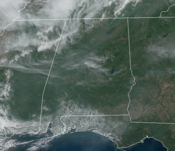
HOT IS THE WORD: The upper-ridge continues to strengthen over the Deep South, meaning the rest of this week will continue to feature sunny skies, dry conditions, and hot temperatures. Today under a sunny sky with temperatures heading into the low 90s, expect mid 90s tomorrow and Friday.
ACROSS THE USA: Strong to severe thunderstorms are possible on Wednesday in parts of the Ohio Valley, Upper Mississippi Valley and south-central Plains. These storms may produce heavy rain and flooding in the Ohio Valley. Meanwhile, a strong cold front will sweep through the Northwest U.S. with rain, mountain snow and high winds. Finally, heat and record high temperatures are likely across the Southern U.S.
WEEKEND WEATHER: The ridge breaks down this weekend and an approaching cold front will bring an increase in showers and storms across Alabama. The weekend won’t be a “washout”, but showers and storms are expected from time to time. The sky will be occasionally cloudy, and highs will drop back into the upper 70s to low 80s.
NEXT WEEK: For now the week looks fairly routine for the final full week of May with very warm, humid days and random, scattered showers and storms pretty much on a daily basis. Highs will be mostly in the mid to upper 80s.
BEACH FORECAST CENTER: Get the latest weather and rip current forecasts for the beaches from Fort Morgan to Panama City on our Beach Forecast Center page. There, you can select the forecast of the region that you are interested in visiting.
WORLD TEMPERATURE EXTREMES: Over the last 24 hours, the highest observation outside the U.S. was 117.1F at Bandar-E-Dayyer, Iran. The lowest observation was -101.6F at Vostok, Antarctica.
CONTIGUOUS TEMPERATURE EXTREMES: Over the last 24 hours, the highest observation was 111F at Rio Grande Village, TX. The lowest observation was 20F at Mount Washington, NH.
Category: Alabama's Weather, ALL POSTS


