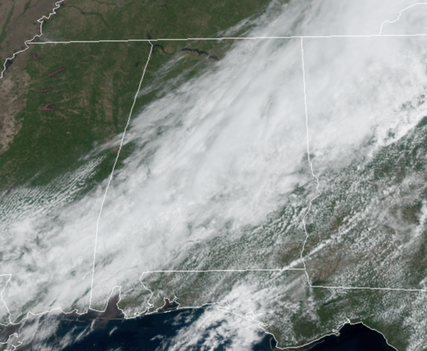
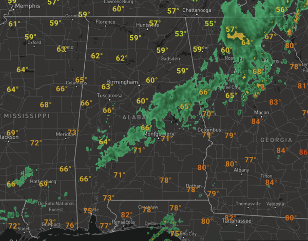
Midday Nowcast: Improving Weather this Afternoon
The rain is winding down across North/Central Alabama, and it is shifting south and east. For the rest of today, we should see a clearing sky from northwest to southeast as drier and cooler air flows into the state this afternoon behind the front.
Temperatures are cooler today with most locations in the 60s to low 70s. Tonight will be clear and chilly with widespread low to mid 40s by first thing tomorrow morning.
REST OF WEEK: Quiet weather the rest of this work week with sunny days, fair nights, and a warming trend. The high tomorrow will be in the mid 70s, then close to 80° Thursday, followed by low to mid 80s Friday.
WEEKEND WEATHER: Moisture levels will slowly rise over the weekend, but we should stay dry due to an upper ridge in place over the Deep South. For both Saturday and Sunday expect a partly sunny sky, and on Sunday a few spotty showers could show up over the northern half of the state, but many places will stay rain-free. Highs will be in the mid 80s over the weekend.
NEXT WEEK: No big ticket weather items showing top as we head into the month of May; the weather looks quiet with warm days. Late in the week, we need to mention a chance of showers Thursday as a front sags into the state, but rain amounts probably won’t be too heavy with the ridge in place. Highs will be in the 80s much of the week.
BEACH FORECAST CENTER: Get the latest weather and rip current forecasts for the beaches from Fort Morgan to Panama City on our Beach Forecast Center page. There, you can select the forecast of the region that you are interested in visiting.
WORLD TEMPERATURE EXTREMES: Over the last 24 hours, the highest observation outside the U.S. was 115.5F at Nawabshah, Pakistan. The lowest observation was -93.5F at Concordia, Antarctica.
CONTIGUOUS TEMPERATURE EXTREMES: Over the last 24 hours, the highest observation was 97F at Pala,CA. The lowest observation was 12F at Peter Sinks, UT.
Category: Alabama's Weather, ALL POSTS


