A Brief Check on Our Weather Just Before Midnight
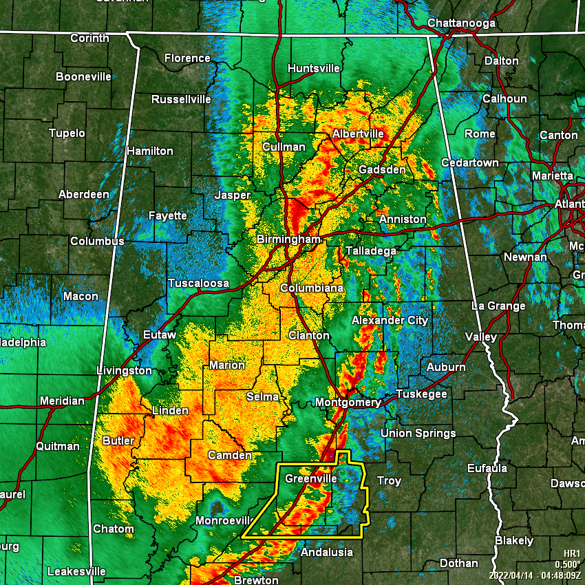
As of 11:48 pm, there are no active severe thunderstorm warnings in effect for anywhere in North/Central Alabama, as the line of storms has moved into more stable air and is becoming a little disorganized. The severe weather threat continues to lessen as we go further into the night and about to cross over into the overnight hours.
A Severe Thunderstorm Watch continues until 2 am for Autauga, Coosa, Elmore, Jefferson, Lowndes, Montgomery, St. Clair, and Talladega counties in Central Alabama, but as the storms exit these counties, the watch will be cancelled a couple of counties at a time as the threat ends for those locations.
Much of the western half of the area is rain free, and that general trend will continue through the overnight hours. That main line should be out of the southeastern parts of the area just before daybreak. The latest HRRR is showing a few scattered showers developing behind the line, but these will be light to moderate in nature and not severe.
Category: ALL POSTS
About the Author (Author Profile)
Scott Martin is an operational meteorologist, professional graphic artist, musician, husband, and father. Not only is Scott a member of the National Weather Association, but he is also the Central Alabama Chapter of the NWA president. Scott is also the co-founder of Racecast Weather, which provides forecasts for many racing series across the USA. He also supplies forecasts for the BassMaster Elite Series events including the BassMaster Classic.Subscribe
If you enjoyed this article, subscribe to receive more just like it.


