
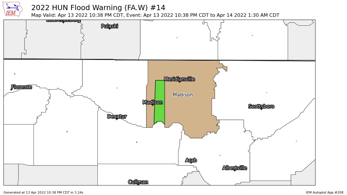
AREAL FLOOD WARNING: Parts of Madison Co. Until 1:30 am
…FLOOD WARNING IN EFFECT UNTIL 130 AM CDT THURSDAY…
* WHAT…Urban area and small stream flooding caused by excessive
rainfall is expected.
* WHERE…A portion of north central Alabama in the immediate
vicinity of Indian Creek, including the following county, Madison.
* WHEN…Until 130 AM CDT.
* IMPACTS…Flooding of Indian Creek and adjacent low-lying and
flood-prone locations is imminent.
* ADDITIONAL DETAILS…
– At 1035 PM CDT, Gauge reports indicated stream levels on
Indian Creek rising rapidly due to excessive runoff created
by heavy rainfall and thunderstorms. Flooding is expected to
begin shortly in the warned area. Between 1.5 and 2.5 inches
of rain have fallen.
– Additional rainfall amounts of 1 to 2 inches are possible in
the warned area.
– Some locations that will experience flooding include…
Northwestern Huntsville, Madison, Redstone Arsenal, Triana,
Marshall Space Flight Center and Harvest.
– http://www.weather.gov/safety/flood
PRECAUTIONARY/PREPAREDNESS ACTIONS…
Be especially cautious at night when it is harder to recognize the
dangers of flooding.
Category: ALL POSTS
About the Author (Author Profile)
Scott Martin is an operational meteorologist, professional graphic artist, musician, husband, and father. Not only is Scott a member of the National Weather Association, but he is also the Central Alabama Chapter of the NWA president. Scott is also the co-founder of Racecast Weather, which provides forecasts for many racing series across the USA. He also supplies forecasts for the BassMaster Elite Series events including the BassMaster Classic.Subscribe
If you enjoyed this article, subscribe to receive more just like it.


