
EXPIRED — SEVERE T-STORM WARNING: Parts of Limestone, Madison, Morgan Co. Until 9 pm
The National Weather Service in Huntsville Alabama has issued a
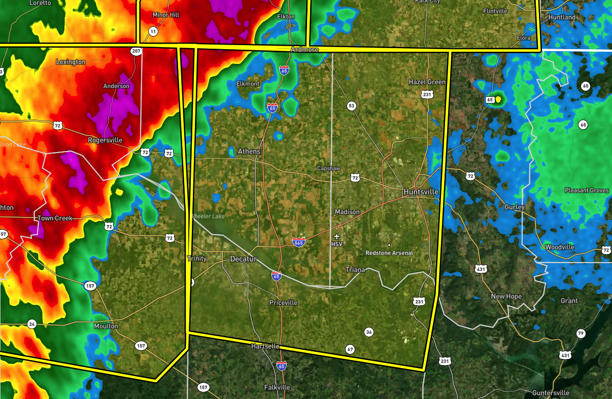
* Severe Thunderstorm Warning for…
Western Madison County in north central Alabama…
Limestone County in north central Alabama…
Central Morgan County in north central Alabama…
* Until 900 PM CDT.
* At 802 PM CDT, severe thunderstorms were located along a line
extending from 14 miles southwest of Pulaski to Rogersville to Town
Creek to 6 miles east of Littleville, moving east at 40 mph.
HAZARD…60 mph wind gusts.
SOURCE…Radar indicated.
IMPACT…Expect damage to roofs, siding, and trees.
* Locations impacted include…
Huntsville, Decatur, Madison, Athens, Hartselle, Redstone Arsenal,
Meridianville, Moores Mill, Hazel Green and Priceville.
PRECAUTIONARY/PREPAREDNESS ACTIONS…
For your protection move to an interior room on the lowest floor of a
building.
Torrential rainfall is occurring with these storms, and may lead to
flash flooding. Do not drive your vehicle through flooded roadways.
Category: Alabama's Weather, ALL POSTS, Severe Weather
About the Author (Author Profile)
Scott Martin is an operational meteorologist, professional graphic artist, musician, husband, and father. Not only is Scott a member of the National Weather Association, but he is also the Central Alabama Chapter of the NWA president. Scott is also the co-founder of Racecast Weather, which provides forecasts for many racing series across the USA. He also supplies forecasts for the BassMaster Elite Series events including the BassMaster Classic.Subscribe
If you enjoyed this article, subscribe to receive more just like it.


