Midday Nowcast: Clouds with Areas of Rain Today
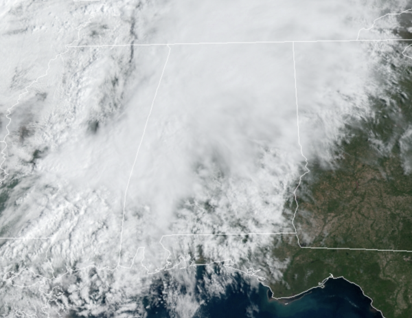
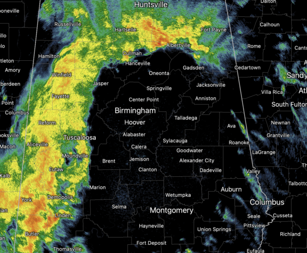
More clouds than sun across Alabama today, and we are seeing scattered showers and storms as well. These will continue at times through the afternoon and evening hours. Highs today are in the low to mid 70s.
Tonight will feature clouds with a few spotty showers, lows will be near 60°. Tomorrow will continue to feature more clouds than sun, with some widely scattered shower, and the occasional rumble of thunder. Highs tomorrow will be closer to 80°.
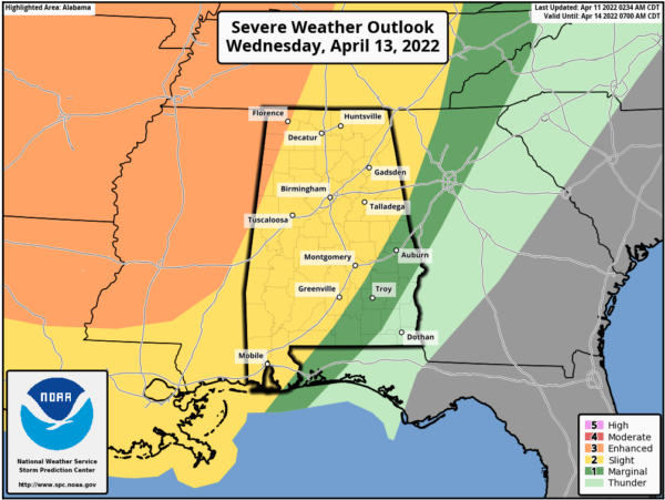
STRONG/SEVER STORMS RETURN: Most of Wednesday will be dry, with only scattered showers, but a cold front will bring an organized band of rain and storms into the state Wednesday night into the pre-dawn hours Thursday. The SPC has an “enhanced risk” (level 3/5) of severe thunderstorms defined for the northwest corner of the state… most of Alabama is in a “slight risk” (level 2/5). The exception is over the southeast counties, where the storms will be weakening, and a “marginal risk” (level 1/5) is in place there.
Late Wednesday night, a line of storms will enter Northwest Alabama, and will pass through the state during the early morning hours Thursday. For most places, the line will be moving through late Wednesday night 10PM-7AM Thursday. The main threat will come from strong, potentially damaging straight line winds. With the main dynamics well to the north, shear values won’t be especially high, so the tornado threat for now looks low. But, as always in a case like this, you can’t rule out an isolated tornado in the line.
The sky becomes partly to mostly sunny during the day Thursday as dry air returns… and Friday looks dry with a good supply of sunshine. The high both days will be in the mid 70s, right at seasonal averages.
EASTER WEEKEND WEATHER: The front will move back north as a warm front, bringing rain back into Alabama both days this weekend. Showers will begin as early as Saturday afternoon, and periods of rain are likely Saturday night and Sunday as the front stalls out over the region. Some thunder is possible, but for now severe storms are not expected. Highs will remain in the 70s.
BEACH FORECAST CENTER: Get the latest weather and rip current forecasts for the beaches from Fort Morgan to Panama City on our Beach Forecast Center page. There, you can select the forecast of the region that you are interested in visiting.
WORLD TEMPERATURE EXTREMES: Over the last 24 hours, the highest observation outside the U.S. was 116.1F at Matam, Senegal. The lowest observation was -85.7F at Amundsen-Scott South Pole Station, Antarctica.
CONTIGUOUS TEMPERATURE EXTREMES: Over the last 24 hours, the highest observation was 103F at Zapata, TX. The lowest observation was 3F at Burgess Junction, WY.
Category: Alabama's Weather, ALL POSTS


