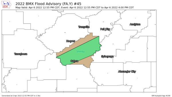
EXPIRED — AREAL FLOOD ADVISORY: Parts of Shelby Co. Until 4 pm
…FLOOD ADVISORY IN EFFECT UNTIL 4 PM CDT THIS AFTERNOON…
* WHAT…Urban and small stream flooding caused by excessive
rainfall is expected.
* WHERE…A portion of central Alabama, including the following
county, Shelby.
* WHEN…Until 400 PM CDT.
* IMPACTS…Minor flooding in low-lying and poor drainage areas.
Ponding of water in urban or other areas is occurring or is
imminent.
* ADDITIONAL DETAILS…
– At 1255 PM CDT, Doppler radar indicated heavy rain due to
thunderstorms. This is causing urban and small stream
flooding. Between 0.5 and 1 inch of rain has fallen.
– Additional rainfall amounts up to 1 inch are expected over
the area. This additional rain will result in minor flooding.
– Some locations that will experience flooding include…
Alabaster, Pelham, Helena, Calera, Chelsea, Montevallo,
Childersburg, Columbiana, Wilsonville, Vincent, Harpersville,
Westover, Wilton, Oak Mountain State Park, Shelby County
Airport, American Village, Maylene, University Of Montevallo,
Bounds Lake and Ballantrae.
PRECAUTIONARY/PREPAREDNESS ACTIONS…
Turn around, don’t drown when encountering flooded roads. Most flood
deaths occur in vehicles.
Category: Alabama's Weather, ALL POSTS


