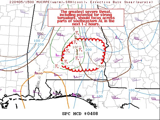
Mesoscale Discussion — Greatest Severe Threat Over South-Central & Southeastern Parts of Central Alabama
The severe weather threat for Tornado Watch 95 continues.
SUMMARY… The greatest severe threat, including the potential for strong tornadoes, should focus across parts of southeastern Alabama in the next 1-2 hours.
DISCUSSION… A small bowing line and two leading supercells ahead of it will continue to move eastward across parts of southeastern AL this morning. The low-level airmass ahead of this activity is not overly unstable, but boundary-layer instability will probably be sufficient for a persistent severe threat. Recent VWPs from KMXX and KEOX show a very favorable low-level wind profile, with 0-1 km SRH exceeding 400 m2/s2. Indeed, strong low-level rotation has been noted with both leading supercells, and a tornado threat remains apparent. A strong tornado also remains a possibility given the strength of the low-level flow and enhanced hodograph in the 0-3 km layer. Damaging winds should be a threat with the bowing line as well.
Category: Alabama's Weather, ALL POSTS, Severe Weather


