A Brief Check on Our Weather Just Before 10 am
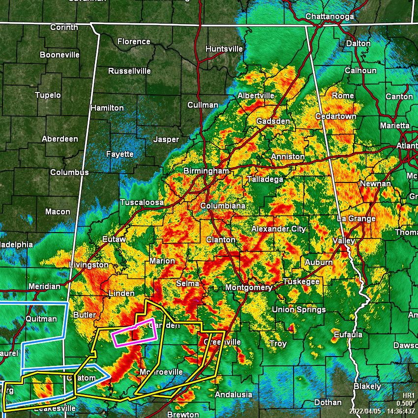
At 9:36 am, rain and storms continue for nearly everyone in three out of the four quadrants of North/Central Alabama. Rain has ended for the northwestern quarter of the area, and other than a few stray showers that pop up during the main heating of the day, much of the activity is over for those locations. However, rain and storms will be continuing for several more hours for the southern half of the area, while rain will be mostly ending for the northeast quarter, potentially as early as 12pm – 1 pm this afternoon.
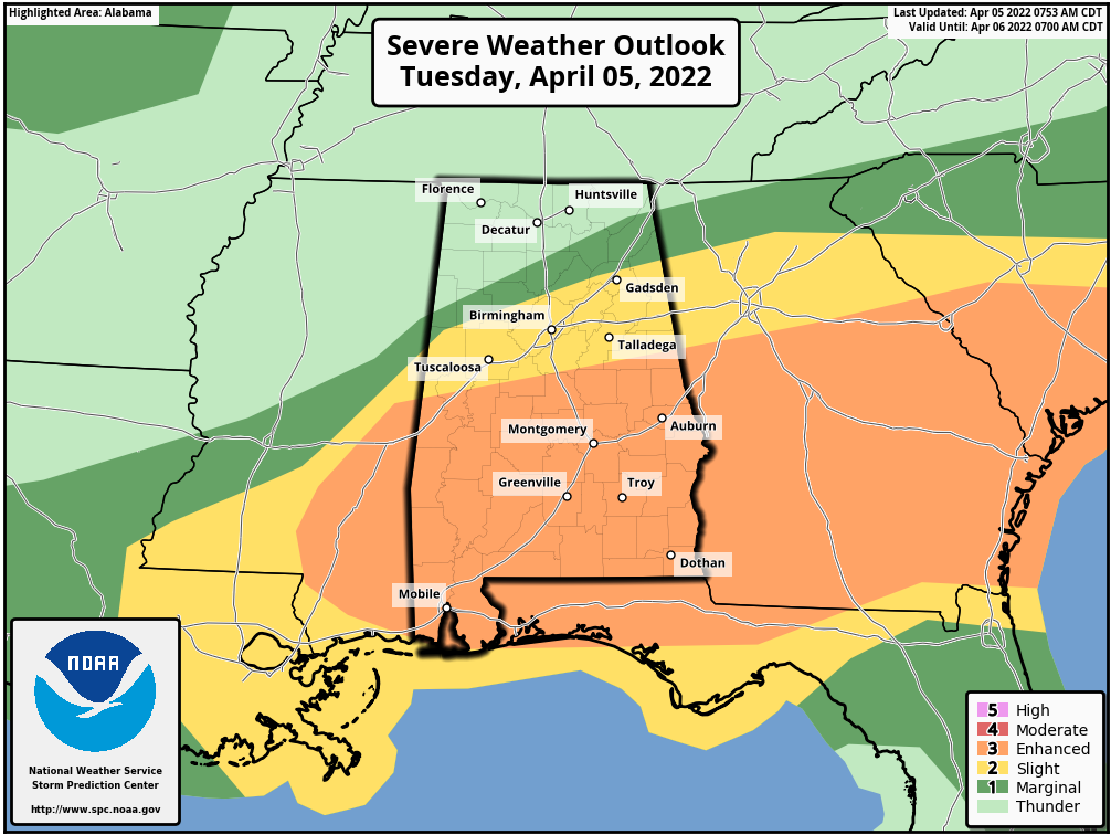
SPC continues an Enhanced Risk for the southern parts of the area, mainly along and south of a line from Eutaw to Calera to Wedowee. A Slight Risk continues north of that to a line from Millport to Hayden to Centre. A Marginal Risk continues north of that to a line from Hamilton to Hartselle to Henagar.
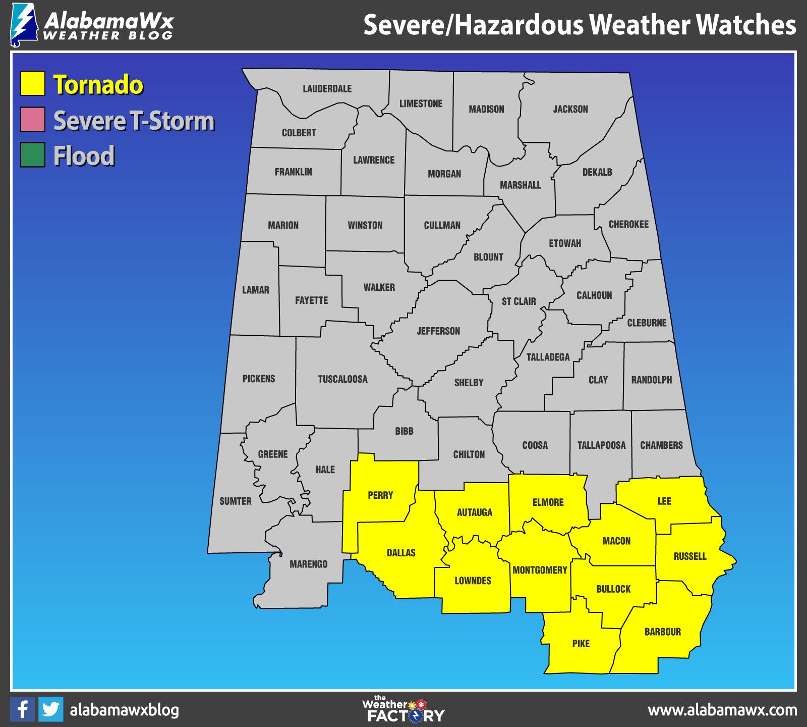
A Tornado Watch continues until 2 pm for Autauga, Barbour, Bullock, Dallas, Elmore, Lee, Lowndes, Macon, Montgomery, Perry, Pike, and Russell counties in the southern parts of Central Alabama. Hale and Marengo counties were just removed from the watch as the threat has ended for those locations.
The severe threat will continue mainly for locations south of the I-20 corridor from now through the rest of the morning hours and will come to an end as the storms push over into Georgia by 3 pm this afternoon. Damaging winds up to 60-70 mph and large hail will be the main threats, but a tornado or two cannot be ruled out.
For now, the better parameters for severe storms are over the southern parts of the state and just makes it into the extreme southern parts of the area. However, better wind shear and helicity is located over the central and north-central parts of the area, so one or two severe thunderstorms cannot be ruled out at this point.
Stay weather aware if you are mainly south of the I-59 corridor. We’ll continue to have updates through the day.
Category: Alabama's Weather, ALL POSTS, Severe Weather
About the Author (Author Profile)
Scott Martin is an operational meteorologist, professional graphic artist, musician, husband, and father. Not only is Scott a member of the National Weather Association, but he is also the Central Alabama Chapter of the NWA president. Scott is also the co-founder of Racecast Weather, which provides forecasts for many racing series across the USA. He also supplies forecasts for the BassMaster Elite Series events including the BassMaster Classic.Subscribe
If you enjoyed this article, subscribe to receive more just like it.


