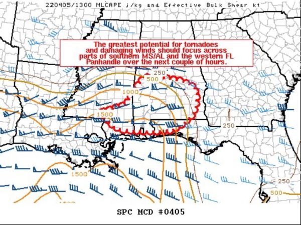
Mesoscale Discussion — Severe Threat Continues for Locations Under the Tornado Watch
The severe weather threat for Tornado Watch 94, 95 continues.
SUMMARY… The greatest potential for tornadoes and damaging winds should focus across parts of southern Mississippi, southern/central Alabama, and the western Florida Panhandle over the next couple of hours.
DISCUSSION… A small bowing line with embedded low-level circulations over parts of southern MS at 1345Z will move eastward across southern/central AL and the western FL Panhandle this morning. Surface-based storms appear most likely where at least mid 60s surface dewpoints are present. Given the linear nature of this ongoing convection and the presence of 45-55 kt of deep-layer shear, damaging winds will continue to be a threat in the short term.
Other, more cellular convection is occurring ahead of the line across southern into central AL within a strong low-level warm advection regime. Ample low-level shear noted on recent VWPs from KMOB and other area radars suggest the threat for tornadoes both within the line and with any supercells ahead of it will also persist this morning as convection spreads eastward across southern AL and the western FL Panhandle. The potential for a strong tornado may exist over portions of southern AL and the far western FL Panhandle in the next 1-2 hours, where the best instability and strongest low-level and deep-layer shear currently overlap.
Category: Alabama's Weather, ALL POSTS, Severe Weather


