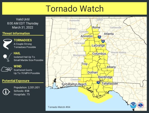
New Tornado Watch Issued for the Eastern Parts of Central Alabama Until 7 am
The Storm Prediction Center and NWS Birmingham has issued a Tornado Watch for the remaining counties east of the previous watch, effective immediately until 7 am Thursday morning. Those Central Alabama counties are Barbour, Bullock, Calhoun, Chambers, Cherokee, Clay, Cleburne, Lee, Macon, Pike, Randolph, Russell, and Tallapoosa.
Text from the SPC:
SUMMARY… The severe storm/tornado risk will shift east-northeastward across the region through the pre-dawn hours. The most intense storms and tornado risk will likely be focused across southeast Alabama, southwest Georgia, and the Florida Panhandle through sunrise, although some severe/tornado potential may exist as far north as northeast Alabama and northwest Georgia, given the very strong low-level shear/helicity.
Category: Alabama's Weather, ALL POSTS, Severe Weather


