EXPIRED — SEVERE T-STORM WARNING: Parts of Fayette, Tuscaloosa Co. Until 10 pm
The National Weather Service in Birmingham has issued a
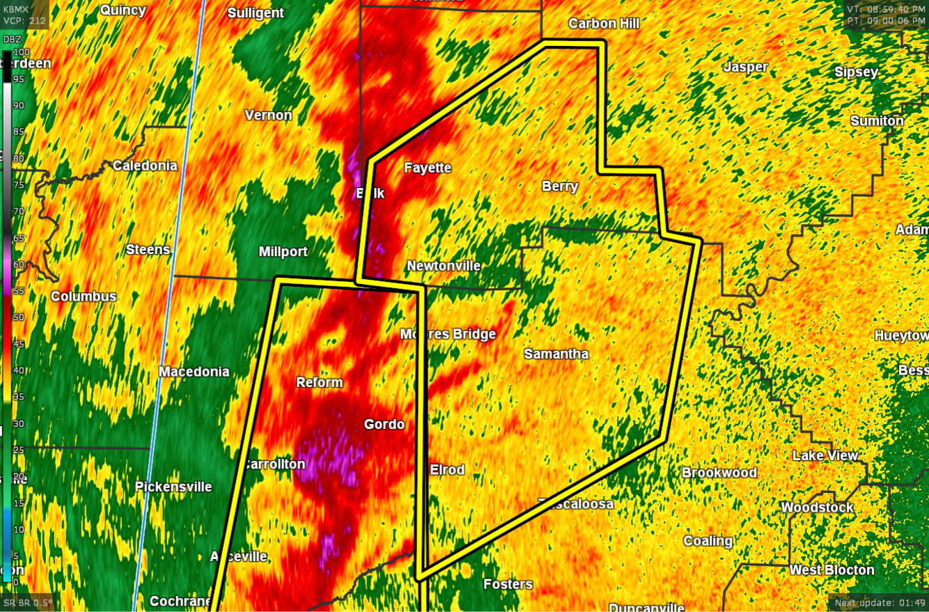
* Severe Thunderstorm Warning for…
Northwestern Tuscaloosa County in west central Alabama…
Fayette County in west central Alabama…
* Until 1000 PM CDT.
* At 901 PM CDT, severe thunderstorms were located along a line
extending from near Belk to near Mantua, moving northeast at 40
mph.
HAZARD…60 mph wind gusts.
SOURCE…Radar indicated.
IMPACT…Expect damage to roofs, siding, and trees.
* Locations impacted include…
Northern Tuscaloosa, Northport, Fayette, Berry, Coker, Belk,
Bankston, Samantha, Lake Lurleen State Park, Tuscaloosa Regional
Airport, Ashcraft Corner, Boley Springs, Binion Creek Landing,
Stone Wall, Whitson, Lake Tuscaloosa, Moores Bridge, Richard Arthur
Field, Windham Springs and Flatwoods.
PRECAUTIONARY/PREPAREDNESS ACTIONS…
A Tornado Watch remains in effect until 100 AM CDT for central and
west central Alabama.
For your protection move to an interior room on the lowest floor of a
building.
Category: Alabama's Weather, ALL POSTS, Severe Weather
About the Author (Author Profile)
Scott Martin is an operational meteorologist, professional graphic artist, musician, husband, and father. Not only is Scott a member of the National Weather Association, but he is also the Central Alabama Chapter of the NWA president. Scott is also the co-founder of Racecast Weather, which provides forecasts for many racing series across the USA. He also supplies forecasts for the BassMaster Elite Series events including the BassMaster Classic.Subscribe
If you enjoyed this article, subscribe to receive more just like it.


