Mesoscale Discussion — Increased Tornado Threat for Parts of Southwest & South-Central Parts of the Area
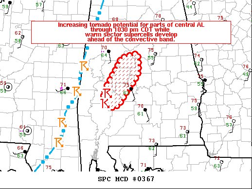
SUMMARY… Increasing tornado potential for parts of southwest and central AL through 1030 pm CDT as warm sector supercells develop ahead of the convective band.
DISCUSSION… Radar imagery from KMOB shows developing supercells over Clarke and Marengo Counties as of 840pm CDT. These storms have recently developed within the warm conveyor belt within an environment characterized by intense low- to mid-tropospheric wind fields (per KBMX 88D VAD data) and weak but increasing buoyancy. The low-level moisture contribution to buoyancy will be the key factor in the conditionality of tornado potential with these storms. It appears the northern rim of mid 60s deg F dewpoints is near this activity. Very strong low-level moisture advection via 50-60 kt 1-2 km southerly flow will act to destabilize the airmass immediately downstream of these storms. As a result of an increasingly favorable environment, tornado potential will likely begin to focus over central AL during the next 2 hours with these warm sector supercells. A strong tornado is possible, especially if updrafts can further intensify/mature.
Category: Alabama's Weather, ALL POSTS, Severe Weather


