Mesoscale Discussion — Locally Higher Tornado Threat Continues for the Next 1-2 Hours
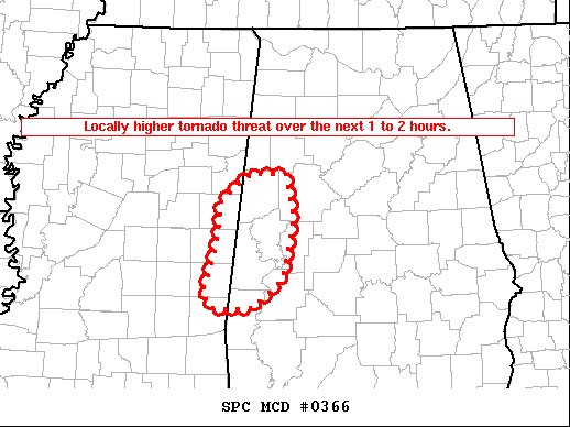
SUMMARY…Locally higher tornado threat over the next 1 to 2 hours.
DISCUSSION… A supercell has developed strong low-level rotation in far northwest Greene County, Alabama. This cell will be absorbed by the main squall line in the next 15 minutes or so, when it becomes less clear how the evolution will continue. At a minimum, an increased threat for significant wind is possible in the vicinity of this storm merger.
Farther south, a line embedded supercell is moving from Lauderdale county, Mississippi into Sumter county, Alabama. This storm has had the tallest echo tops for a while, and has had a few TDS observed across Lauderdale county. The environment ahead of this storm remains favorable for tornadoes. In fact, low-level flow has recently backed in this region, which further increases low-level streamwise vorticity. Therefore, this storm will continue to pose a tornado threat, and potentially a strong tornado threat over the next 1 to 2 hours.
Category: Alabama's Weather, ALL POSTS, Severe Weather
About the Author (Author Profile)
Scott Martin is an operational meteorologist, professional graphic artist, musician, husband, and father. Not only is Scott a member of the National Weather Association, but he is also the Central Alabama Chapter of the NWA president. Scott is also the co-founder of Racecast Weather, which provides forecasts for many racing series across the USA. He also supplies forecasts for the BassMaster Elite Series events including the BassMaster Classic.Subscribe
If you enjoyed this article, subscribe to receive more just like it.


