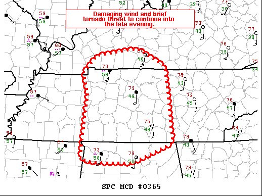
Mesoscale Discussion — Damaging Wind & Tornado Threat Continues for Extreme North Alabama
SUMMARY… A damaging wind and brief tornado threat should continue into the late evening.
DISCUSSION… A broken line of storms continues across middle Tennessee. This line is starting to approach the eastern extent of the better low-level moisture, with dewpoints in the upper 40s in Nashville, TN. The low-level jet continues to be very strong ahead of these storms, with flow as strong as 70 knots at 2 km. This strong low-level flow will aid in damaging winds potential along the line, even as storm intensity starts to weaken as storms move east of the better instability. In fact, as observed farther north in Kentucky, there may be a brief window where strong downbursts are favored as storms move into a drier, more mixed, low-level airmass.
Category: Alabama's Weather, ALL POSTS, Severe Weather


