A Quick Weather Update as of 6 pm
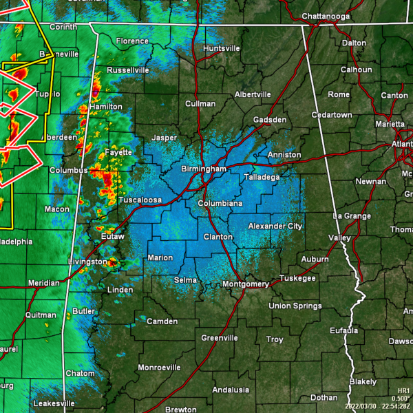
Currently, the main line of storms continue to move across the east-central portions of Mississippi, with four tornado warnings issued on parts of the line. The line itself is around 1 hour away from entering the western parts of North/Central Alabama. With that being said, a few clusters of storms have moved into the western parts of the area, but these are staying well below severe limits at the moment.
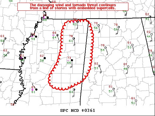
We’ll have to really watch the northwestern parts of the area over the next couple of hours, as the damaging wind and tornado threat will increase as the line with embedded supercells enter into the area. Here is the text from the latest Mesoscale Discussion…
DISCUSSION… The nature of the line has changed a bit over the past 1 to 2 hours, with a less cohesive QLCS and a more embedded cellular structure. Each of the tornado warnings and more sustained low-level circulations are associated with taller cores and reflectivity structures resembling embedded supercells. This change in nature of the line and a favorable low-level shear environment (0-1 km SRH in excess of 300 m2/s2 per KGWX VWP) may lead to an increase in tornado productivity for the next hour or two. Dewpoints are lower across Alabama, but some low-level moisture increase is expected, and the environment remains favorable for tornadoes through the evening and into the overnight hours.
Category: Alabama's Weather, ALL POSTS, Severe Weather


