A Brief Check on Our Weather Situation at 8 pm
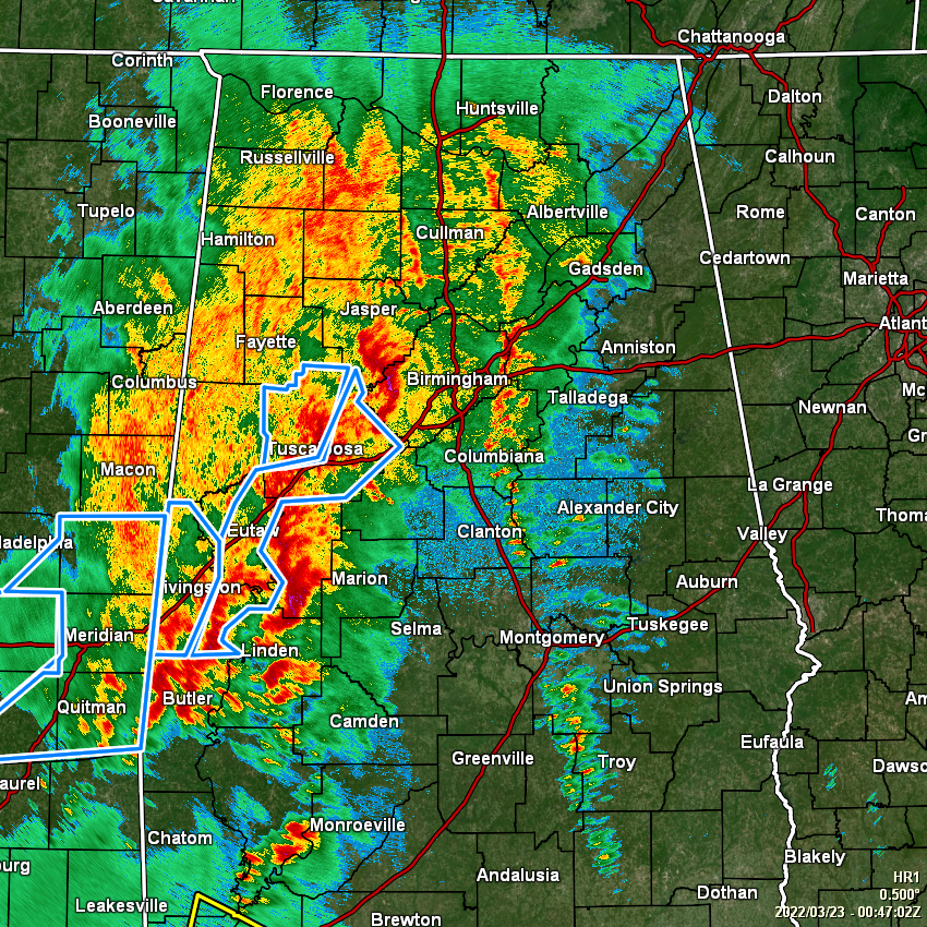
Rain and storms continue to fall over the western half of the area and extending into the east-central and northeastern parts of the area, but the good news is that there are no severe weather warnings in effect across North/Central Alabama. The bad news is that there are several Flash Flood Warnings along with Areal Flood Advisories in effect for several counties in the area. I have seen some rainfall totals on NWS Chat over 4 inches already with more rain falling.
The severe threat is dropping across the area as surface-based instability values are low across the area and falling. The best instability at this time can be found in the extreme southwestern parts of the state and back into extreme southern Mississippi and southeastern Louisiana. The main threat for us throughout the remainder of the night and into the overnight hours will be gusty wind and heavy rainfall, which could lead to more flooding issues. There will be some lightning involved as well, but as instability drops, so will the lightning activity.
Unfortunately, we have had a few damage reports from across the area, some of which in portions of Tuscaloosa County and back into Greene County may have been caused by a brief tornado. We’ll have locations on that damage when they are put out in an official statement by NWS.
More counties are about to be removed from the Tornado Watch, most likely it will be Greene, Sumter, and Walker counties, as the severe weather threat has ended and stable air has moved in. The Tornado Watch will continue until 11 pm for Hale, Marengo, Tuscaloosa, Autauga, Bibb, Blount, Chilton, Dallas, Jefferson, Lowndes, Perry, Shelby, and St. Clair counties.
Category: Alabama's Weather, ALL POSTS, Severe Weather
About the Author (Author Profile)
Scott Martin is an operational meteorologist, professional graphic artist, musician, husband, and father. Not only is Scott a member of the National Weather Association, but he is also the Central Alabama Chapter of the NWA president. Scott is also the co-founder of Racecast Weather, which provides forecasts for many racing series across the USA. He also supplies forecasts for the BassMaster Elite Series events including the BassMaster Classic.Subscribe
If you enjoyed this article, subscribe to receive more just like it.


