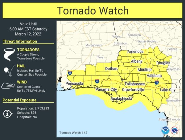
Tornado Watch Issued for Counties South and East of the Area Until 5 am Saturday
NWS Birmingham has opted to not include any southeastern counties in Central Alabama in the Tornado Watch that was just issued for South Alabama, the Florida Panhandle, and southwestern Georgia, as the threat seams just to be marginal, and the low level jet doesn’t ramp up until you move east of our area. Here is the text from the SPC:
The NWS Storm Prediction Center has issued a
• Tornado Watch for portions of
— Southeast Alabama
— Florida Panhandle
— Southwest Georgia
— Coastal Waters
• Effective this Friday night and Saturday morning from 1110 PM
until 600 AM EST.
• Primary threats include…
— A few tornadoes and a couple intense tornadoes possible
— Scattered damaging winds likely, with isolated significant gusts to 75 mph possible
SUMMARY… A fast-moving linear cluster should develop from southwest Alabama and spread into southern Georgia, while semi-discrete supercells may emanate out of the northeast Gulf across the Florida Panhandle.
Category: Alabama's Weather, ALL POSTS, Severe Weather


