The Severe Weather Threat Has Ended; Tornado Watch In the Process of Being Canceled for North/Central Alabama
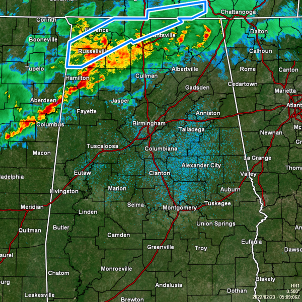
As of 11:10 pm, there are no active tornado or severe thunderstorm warnings for any county in North/Central Alabama. However, rain and thunderstorms continue to fall over the already drenched parts of the area, now stretching from just north of Fort Payne back to Hartselle and back to Sulligent before exiting back over into eastern Mississippi.
NWS Birmingham has canceled the Tornado Watch for the remaining Central Alabama counties of Fayette, Lamar, Marion, Walker, and Winston, as the severe weather threat has dissipated for tonight. However, training of heavier cells may lead to some minor flooding issues throughout the rest of the late-night and overnight hours along and north of the I-59 and I-59/20 corridors. NWS Huntsville should be in the process of canceling the Tornado Watch for the remaining North Alabama counties of Cullman, Franklin, Jackson, Lawrence, Limestone, Madison, and Morgan, as they have discussed that with Birmingham.
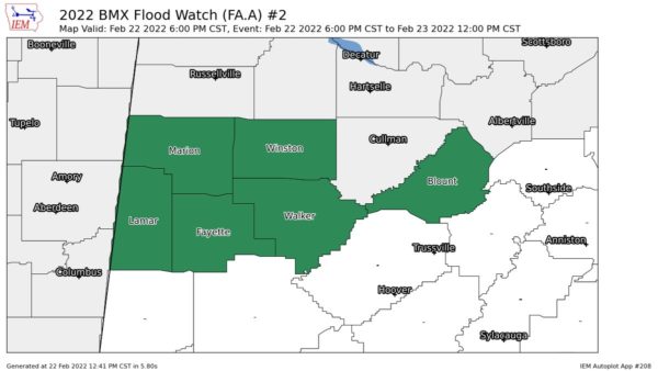
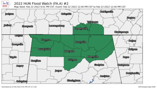
As mentioned above, the main threat now turns to heavier rainfall totals and training of those heavier cells, which could lead to some flooding issues for a few locations in North Alabama and in the extreme northern parts of Central Alabama. A Flood Watch continues until midday Wednesday for Blount, Fayette, Lamar, Marion, Walker, and Winston counties in Central Alabama, and for Colbert, Cullman, DeKalb, Franklin, Jackson, Lauderdale, Lawrence, Limestone, Madison, Marshall, and Morgan counties in North Alabama.
Category: Alabama's Weather, ALL POSTS, Severe Weather


