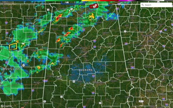
A Brief Radar Check Just After 8:30 pm
There is not much going on if you are along and south of the I-59 and I-20/59 corridors, as all of the action has remained to the north of those interstates. We’ve had a few warnings issued with some minor report of damage, but nothing too serious at this point. The first line of storms are approaching Scottsboro, Cullman, and Berry, with the second line of storms stretching from Athens to Russellville. The good news is that a tornado warning was just canceled for Madison County as the rotation became more broad and weaker.
The better low-level shear is now starting to push on over into the northwestern Georgia, so the overall tornado threat is starting to slowly decrease. Instability values have dropped over the western half of the area now running just over 500 J/kg and lower. The Violent Tornado Parameter has dropped in half and is now ranging from 1-2 over the north and western parts of the area.
Storms should continue to slowly weaken as they move eastward into a little more stable air. However, a tornado watch continues for much of North Alabama and a decent portion of Central Alabama until midnight tonight. NWS Birmingham is now in discussion on the continuation and duration of the current watch. I do not believe a new watch will be issued downstream.
Category: Alabama's Weather, ALL POSTS, Severe Weather


