EXPIRED — Areal Flood Advisory for Parts of Tuscaloosa Co. Until 8:30 pm
…FLOOD ADVISORY IN EFFECT UNTIL 830 PM CST THIS EVENING…
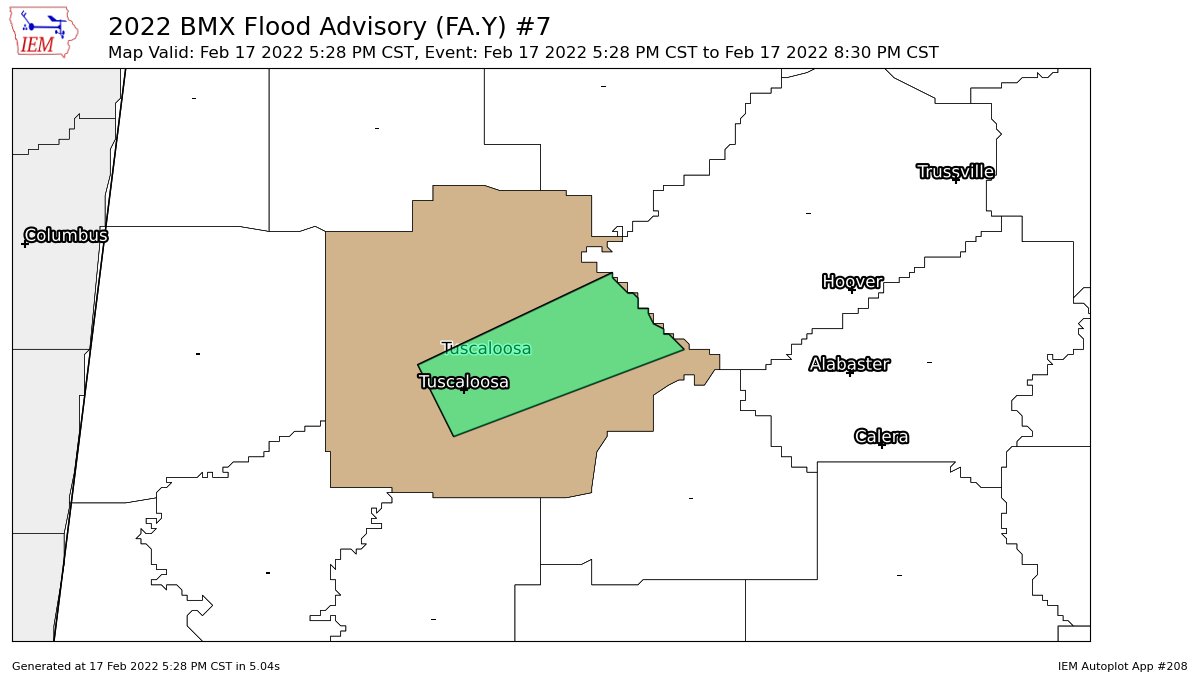
* WHAT…Urban and small stream flooding caused by excessive
rainfall is expected.
* WHERE…A portion of central Alabama, including the following
county, Tuscaloosa.
* WHEN…Until 830 PM CST.
* IMPACTS…Minor flooding in low-lying and poor drainage areas.
* ADDITIONAL DETAILS…
– At 528 PM CST, Doppler radar indicated heavy rain due to
thunderstorms. This will cause urban and small stream
flooding.
– Some locations that will experience flooding include…
Tuscaloosa, Northport, Holt, Lake View, Brookwood, Deerlick
Creek Campgrounds, University Mall, Bryant Denny Stadium,
McFarland Mall, Tuscaloosa Amphitheater, Tuscaloosa Regional
Airport, Abernant, Fleetwood, Holt Lock And Dam, Peterson,
Lake Harris, Lake Nicol Park, Lake Nicol, Lake Tuscaloosa Dam
and Cottondale.
PRECAUTIONARY/PREPAREDNESS ACTIONS…
Turn around, don’t drown when encountering flooded roads. Most flood
deaths occur in vehicles.
Category: Alabama's Weather, ALL POSTS
About the Author (Author Profile)
Scott Martin is an operational meteorologist, professional graphic artist, musician, husband, and father. Not only is Scott a member of the National Weather Association, but he is also the Central Alabama Chapter of the NWA president. Scott is also the co-founder of Racecast Weather, which provides forecasts for many racing series across the USA. He also supplies forecasts for the BassMaster Elite Series events including the BassMaster Classic.Subscribe
If you enjoyed this article, subscribe to receive more just like it.


