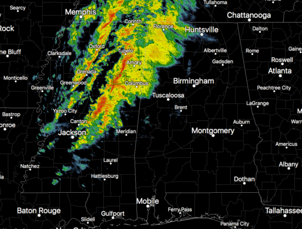
Brief Radar Update at 2:20 pm
Prefrontal rain has moved into the west and northwestern parts of North/Central Alabama that is well below severe criteria. However, the stronger to severe cells are located just off to the west of our activity and is moving to the northeast around 70 mph and will enter the northwestern corner of the area by 3:00-3:15 pm.
Instability continues to climb over the western parts of the area ranging from 500-1000 J/kg which is the fuel needed for thunderstorm development and continuation. Wind shear in the extreme lower levels are in the 40-50 knot range and in the 70-90 knot range up to 6 km high in the atmosphere. STP values are climbing over those same areas, exceeding 1.0 to the MS/AL state line, and reaching as high as 4.0 over Central Mississippi. Those more impressive values will continue to move into the area this afternoon.
Stay weather aware and be prepared to take action immediately if your location goes under a warning.
Category: Alabama's Weather, ALL POSTS, Severe Weather


