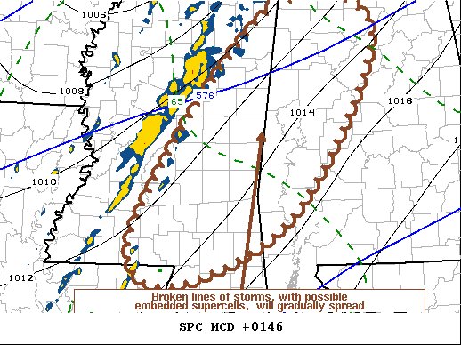
Mesoscale Discussion — Potential for A Few Supercells Capable of Producing Tornadoes in Watch Area
A broken band or bands of thunderstorms will continue to slowly shift eastward across Mississippi into Alabama late this afternoon, with the potential for a few supercells to continue to develop and pose a risk for producing tornadoes.
While the more favorable large-scale ascent, and intense lower/mid tropospheric jet core, are passing to the north of the region (across the lower Ohio and Tennessee Valleys), a corridor of 50-70 kt flow trails along an axis into the Louisiana Gulf coast vicinity. This is forecast to gradually shift eastward through late afternoon, with associated low-level moistening and destabilization remaining a potential focus for vigorous thunderstorm development.
A broken leading line of thunderstorms spreading east of the Interstate 55 corridor of Mississippi appears near the eastern periphery of the narrow corridor of deeper boundary-layer moisture advecting inland off the Gulf of Mexico. This is trailed by additional pre-frontal developing broken bands of convection, which may continue to slowly intensify in the presence of weak mixed-layer CAPE. Given the strong low-level and deep-layer shear, the environment may become conducive to the evolution of a few supercells, which could pose a risk for producing tornadoes.
Category: Alabama's Weather, ALL POSTS, Severe Weather


