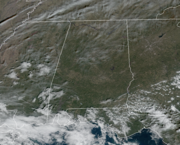
Midday Nowcast: Quiet Weather Persist
High pressure remains firmly in control of our weather across the Southeast today. It is another day with tons of sunshine, and after the freezing start to the day, we are seeing temperatures head into the 50s this afternoon. Little change in the weather tomorrow and Friday with more sun than clouds, and highs in the mid to upper 50s expected across much of North/Central Alabama.
USA BRIEF: Heavy rainfall will continue to bring flooding and landslide risks in Washington across the Olympic Peninsula and Northern Cascades into Thursday. A Canadian storm system is expected to bring accumulating snowfall to the Northern Plains Thursday night into Friday. The winter storm system is expected to impact the Mid-South, Southeast, and East Coast this weekend.
WEEKEND WEATHER: Clouds being to increase Saturday with widespread rain overspreading the state through the afternoon and evening hours. Moisture return is increasing and a soaking rain is in the forecast from the system, especially Saturday night. There won’t be much instability so there could be some rumbles of thunder, but no severe storms. Rainfall totals should be closer to one inch for much of the area. Highs Saturday will be in the 50s.
WINTRY MISCHIEF: Sunday will be much colder as temperature will be falling and will likely fall into the 30s by afternoon with a blustery north wind. There will be enough lingering moisture that we are likely to see the rain turn into snow showers of the northern third of the state (Interstate 20 north).
Some light accumulation is possible in grassy areas, temperatures should be a little above freezing and roads will remain wet through the afternoon. Snow showers will end Sunday evening, and we will have to watch for patchy black ice on bridges Sunday night as temperatures will go below freezing by then.
Of course, the forecast could change as we get closer to the weekend. But, for now most of the precipitation with the weekend system in Alabama will come from rain, with potential for the snow showers Sunday on the back side of the system. The bigger winter weather issues will come northeast of Alabama, across northern Georgia and the Carolinas, where snow and the potential for an ice storms are likely.
BEACH FORECAST CENTER: Get the latest weather and rip current forecasts for the beaches from Fort Morgan to Panama City on our Beach Forecast Center page. There, you can select the forecast of the region that you are interested in visiting.
WORLD TEMPERATURE EXTREMES: Over the last 24 hours, the highest observation outside the U.S. was 115.7F at Port Headland Airport, Australia. The lowest observation was -46.7F at Selagoncy, Russia.
CONTIGUOUS TEMPERATURE EXTREMES: Over the last 24 hours, the highest observation was 85F at Santa Ana, CA. The lowest observation was -25F at Knowls Corner, ME.
Category: Alabama's Weather, ALL POSTS


