Potential of Severe Storms Increasing Over Central Alabama
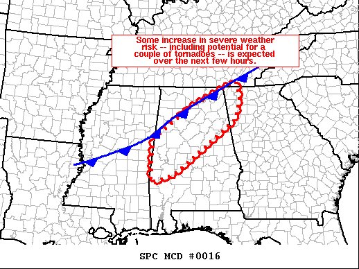
The latest Mesoscale Discussion from the SPC states that there may be some increase in the severe weather risk over Central Alabama over the next few hours, including the potential for a couple of tornadoes. Here is the text from the discussion:
SUMMARY… Risk for severe weather — including potential for a couple of tornadoes — continues across the WW areas, with some increase in potential expected over the next few hours.
DISCUSSION… The latest water vapor loop suggests that mid- and upper-level heights are gradually falling across the central Gulf Coast region at this time, as the upper trough crossing the central and southern Plains advances.
South of the southward-moving surface cold front — now bisecting Mississippi from southwest to northeast and extending across northern Alabama and eastern Tennessee, the boundary layer remains quite moist. This — combined with the mid-level ascent aiding in some steepening of lapse rates, is helping to maintain 500 to 1000 J/kg mixed-layer CAPE across this area per RUC-based objective analyses. In tandem with the subtly increasing ascent, an uptick in convective coverage/intensity is noted over the past hour across the region, and expect this trend to continue over the next few hours (in line with HRRR and other recent CAM runs).
Given the very favorable background kinematic environment, risk that a few severe/rotating storms re-emerge remains apparent. Along with potential for locally damaging winds, a couple of tornadoes remain a possibility overnight.
Category: Alabama's Weather, ALL POSTS, Severe Weather


