A Brief Check on Our Weather Just After 11 pm
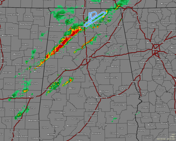
We have a few clusters of storms out there across the central and southwestern parts of the area that are staying well-behaved and not showing any threats of becoming severe at the moment. What we are really watching is the intense line of storms that seem to be growing in strength stretching from the northeastern parts of Jackson County down to the southwest through Decatur and Double Springs and stretches back into Mississippi just east of Columbus. Very heavy rain, a good bit of lightning, and gusty winds are occurring with this line of storms as the cells within the line are moving to the northeast at 40-45 mph while the trek eastward for the whole system remains rather slow to the east.
Timing for the threat for severe storms will be from now until midnight for locations west of a line from Geiger to Warrior to Fort Payne, from now through 6 am Sunday morning east of that line to a line stretching from Lowndesboro to Jackson’s Gap to Roanoke, and from Sunday 5am to 9 am for locations south of that line which includes Auburn, Montgomery, Eufaula, and Troy. The threats now look to be damaging wind gusts up to 60 mph as the main threat, with a smaller tornado threat.
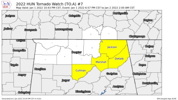
A Tornado Watch remains in effect for Cullman, DeKalb, Jackson, and Marshall counties in North Alabama until 2 am Sunday morning.
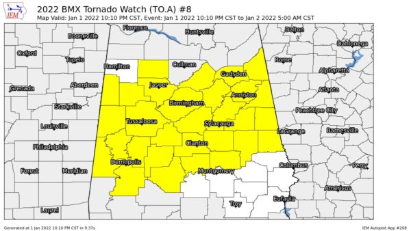
Another Tornado Watch remains in effect until 5 am for Autauga, Bibb, Blount, Calhoun, Chambers, Cherokee, Chilton, Clay, Cleburne, Coosa, Dallas, Elmore, Etowah, Fayette, Greene, Hale, Jefferson, Lamar, Marengo, Perry, Pickens, Randolph, Shelby, St. Clair, Sumter, Talladega, Tallapoosa, Tuscaloosa, Walker, and Winston counties in Central Alabama.
I’ll be with you through the rest of the late-night and overnight hours, and will have the Sunday Weather Xtreme Video out by 7 am, weather permitting.
Category: Alabama's Weather, ALL POSTS, Severe Weather


