We Could See an Uptick in Storm Intensity During the Late-night & Overnight Hours
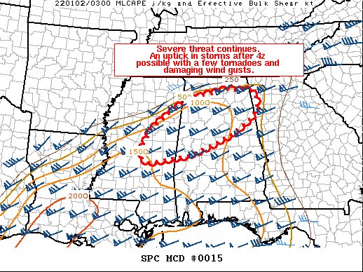
We may see an uptick in storms across North/Central Alabama during the late-night and overnight hours as the environment will remain highly sheared and models are showing that there may be an increase in storm intensity as they will be moving into virtually untapped air. Here’s the latest from the Mesoscale Discussion just released by the SPC:
SUMMARY… The severe threat is expected to continue late this evening past the 4z expiration of Tornado Watch 6. A new watch will likely be coordinated to replace it, as the risk for a few tornadoes and severe wind gusts will remain possible with convection developing after 4z.
DISCUSSION… Latest radar and satellite imagery show weak convection becoming better established across portions of eastern Mississippi ahead of the effective cold front and mid-level trough moving across the Mississippi River. Subtle height falls have been noted over the last few hours, working to remove a stubborn elevated warm layer as observed by regional soundings. The slight increase in forcing for ascent coupled with continued low-level warm advection beneath a 45-60 kt low-level jet will offset nocturnal stabilization across the large warm sector. Hi-res guidance has hinted at a potential increase in thunderstorm coverage after 4z, mainly across eastern MS and west-central AL. Environmental conditions remain favorable for severe storms, including supercells as sampled by 00z RAOBS with sufficient buoyancy (MLCAPE of 500-1000 J/kg) and relatively large hodographs (0-1 km SRH 200-300 m2/s2). Current thinking is that WW6 will be replaced with a new watch across portions of MS, AL, and possible western GA to cover the threat for a few tornadoes and damaging wind gusts through the overnight period.
Category: Alabama's Weather, ALL POSTS, Severe Weather


