A Brief Check on Our Weather Just After 2:30 pm
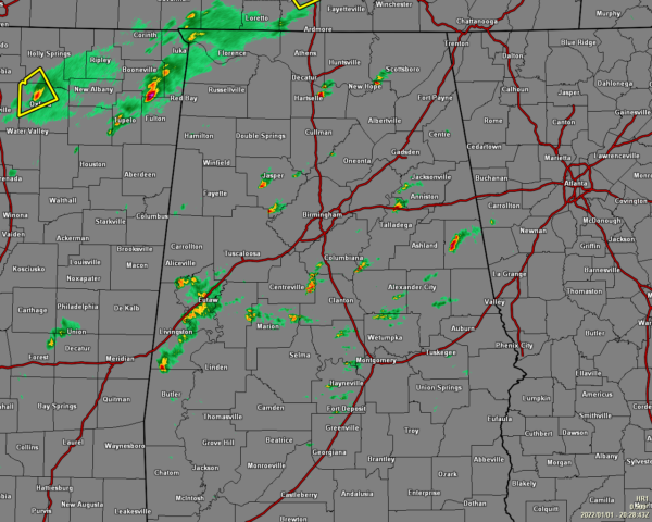
So far, while we have some showers and thunderstorms forming across the area as of 2:30 pm, most of these storms are staying under severe limits as the cap remains in place. However, the cap is weak and is starting to erode, and a few storms may become much stronger to severe over the next couple of hours.
The strongest storm in the area at the moment is located just west of Jemison and is moving northeastward at 40 mph. Gusty winds up to 40 mph can be expected. Locations in the path of this storm are Calera, Jemison, Randolph and Minooka Park.
While the potential for strong to severe storms is continuing to climb, the possibility for stronger, long-track tornadoes is very, very small. However, the environment is still sufficient to support severe storms with the potential of a few lower end tornadoes.
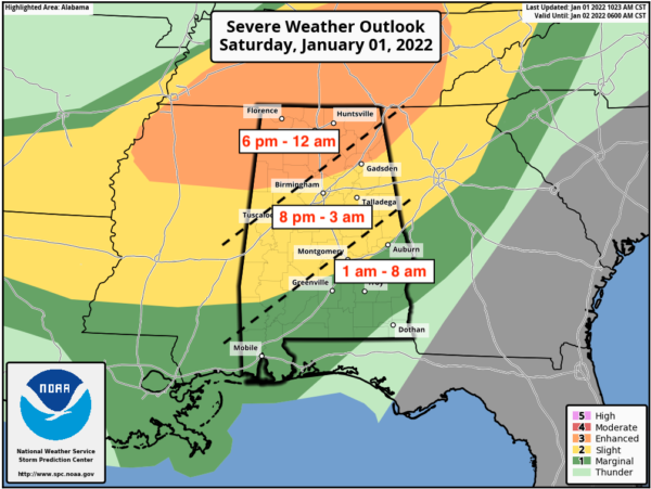
An Enhanced Risk is up for all of North Alabama and much of Central Alabama down to a line roughly from Millport to Kimberly to Centre. A Slight Risk is up south of the Enhanced Risk to a line stretching roughly from Letohatchee to Auburn to Huguley. A Marginal Risk is up south of the Slight Risk for the remainder of Central Alabama.
The main timing for the threat of severe storms looks to start around 6 pm in the northwestern parts of the area and will end around midnight, from 8 pm tonight through 3 am Sunday morning for the locations along and just south of the I-59 corridor, and from 1 am through 8 am Sunday morning for the southern and southeastern parts of the area. However, if any of these storms out there can break through the cap, the threat will start much earlier.
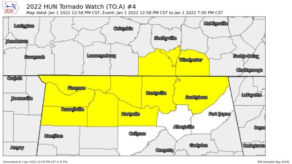
A Tornado Watch continues until 7pm this evening for the following counties in North Alabama: Colbert, Franklin, Jackson, Lauderdale, Lawrence, Limestone, Madison, and Morgan.
I’ll have more updates throughout the rest of the day.
Category: Alabama's Weather, ALL POSTS, Severe Weather


