Saturday Weather Xtreme — Mother Nature Will Have Her Own Fireworks in the Form of Severe Storms Later Today
WIND ADVISORIES: We have a couple of Wind Advisories in effect across North/Central Alabama today. NWS Huntsville has issued one for all of the North Alabama counties from 9 am today and is set to expire at 9 pm tonight. NWS Birmingham has issued the advisory for nearly all of the Central Alabama counties from 10 am this morning until midnight tonight except for Chambers, Lee, Russell, Macon, Bullock, Pike, and Barbour counties in the southeastern parts of the area. Wind gusts up to 40 mph can be expected outside any thunderstorm activity today.
SEVERE WEATHER: We’ll have a chance of scattered showers throughout the morning and into the early afternoon hours, before we may see some stronger thunderstorm start to develop during the late afternoon hours. The front with a line of strong thunderstorms will begin to move into the area by the start of the evening and will slowly progress across the area until exiting during the morning hours on Sunday. We have the threat of severe weather during this time frame in the form of tornadoes and damaging winds up to 60 mph. Highs today will be up in the upper 70s to the lower 80s.
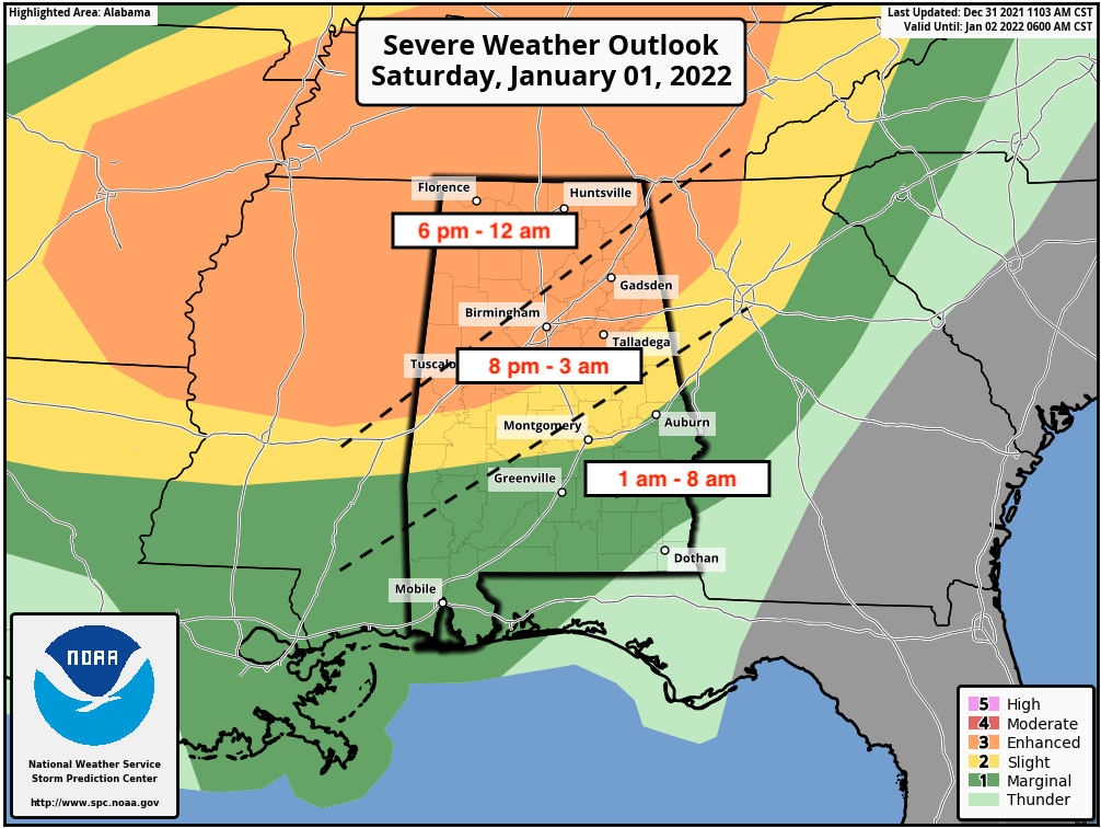
An Enhanced Risk is up for all of North Alabama and much of Central Alabama down to a line from Livingston to just north of Jemison to just east of Heflin. A Slight Risk is up south of the Enhanced Risk to a line stretching from Sweet Water to Hayneville to Auburn. A Marginal Risk is up south of the Slight Risk for the remainder of Central Alabama.
The main timing for the threat of severe storms looks to start around 6 pm in the northwestern parts of the area and will end around midnight, from 8 pm tonight through 3 am Sunday morning for the locations along and just south of the I-59 corridor, and from 1 am through 8 am Sunday morning for the southern and southeastern parts of the area.
The good news with this event is that warm air aloft may inhibit a higher threat of severe storms, and I wouldn’t be surprised if you see these risk levels reduced a little later this morning when the SPC issues the next update after 7 am. However, we’ll continue to have strong wind shear and a decent amount of instability and plenty of helicity, so if any storm grows strong enough to break through the cap of warm air aloft, the potential will be there for it to quickly become severe.
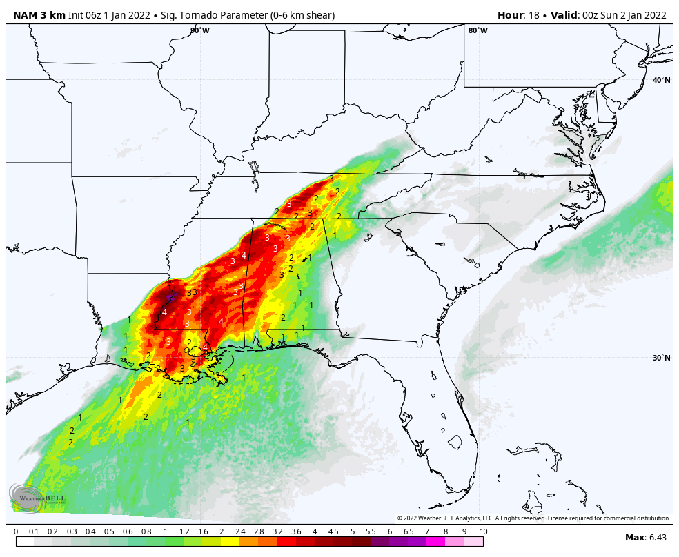
Significant Tornado Parameters from the latest run of the high-resolution NAM shows that we could see values as high as 4.0 over the northwestern parts of the state, meaning that tornadoes will be possible with the potential of a significant tornado. But, like I said earlier, that warm air aloft may limit the storms and keep those significant tornadoes from happening.
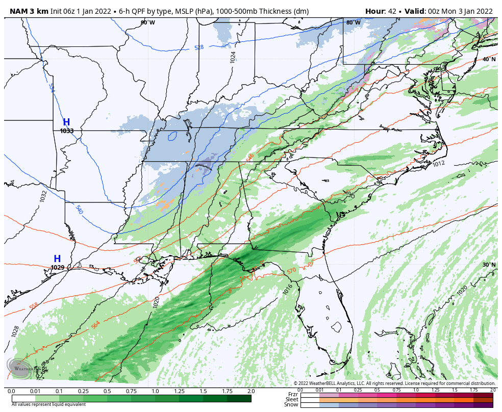
GETTING COLDER ON SUNDAY: The rain and thunderstorm activity along with the cold front will move completely out of the area by the early afternoon on Sunday, but showers will remain possible through the rest of the daylight hours. As the temperatures quickly drop throughout the day and into the evening hours, some of those showers may turn into a light wintry mix or snow flurries. No accumulations are expected, but I wouldn’t be surprised if some patchy ice may form on bridges and overpasses in the northern parts of the area. Highs will occur early in the mid-50s to the lower 70s, but overnight lows will drop into the mid-20s to the mid-30s.
NEXT WEEK: After a chilly start on Monday morning, skies will clear out and sunny skies can be expected from mid-morning through the remainder of the day. Highs will be in the lower 40s to the lower 50s. Much of the same on Tuesday, but it will be just a tad warmer. Highs will be in the lower 50s to near 60 degrees across the area.
Skies will become mostly cloudy on Wednesday as a cold front will approach and move into the area. Showers will become possible by the afternoon hours and will continue across the area through the remainder of the day. Highs will be in the mid-50s to the mid-60s.
Showers will remain possible through the day on Thursday, but those will move out of the area during the early evening hours and skies will remain mostly cloudy. Highs will be in the lower 50s to the mid-60s. Sunny skies will return on Friday, but so will those much colder temperatures. Highs will only reach the lower 40s to the lower 50s.
Category: Alabama's Weather, ALL POSTS, Severe Weather, Weather Xtreme Videos
About the Author (Author Profile)
Scott Martin is an operational meteorologist, professional graphic artist, musician, husband, and father. Not only is Scott a member of the National Weather Association, but he is also the Central Alabama Chapter of the NWA president. Scott is also the co-founder of Racecast Weather, which provides forecasts for many racing series across the USA. He also supplies forecasts for the BassMaster Elite Series events including the BassMaster Classic.Subscribe
If you enjoyed this article, subscribe to receive more just like it.


