Strong/Severe Storms Saturday Morning; Dry Sunday
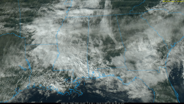
THIS AFTERNOON: We have more clouds than sun across much of Alabama, but showers are confined to Mobile and Baldwin counties at mid-afternoon, close to a front near the Gulf Coast. Temperatures over the northern half of the state are in the 58-64 degree range.
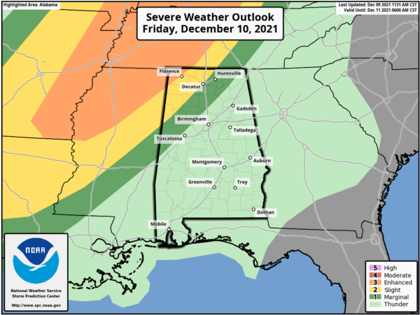
The front will lift northward tonight, and a few scattered showers possible statewide. Temperatures will hold steady through the night. Then, tomorrow, temperatures will climb into the mid 70s, very close to record levels (Birmingham’s record high for December 10 is 79, set in 2007). A few scattered showers or storms are possible tomorrow, but the main action will be northwest of Alabama, where SPC has defined an “enhanced risk” (level 3/5) of severe thunderstorms for parts of the mid-south, including North Mississippi, West Tennessee, Arkansas, and West Kentucky.
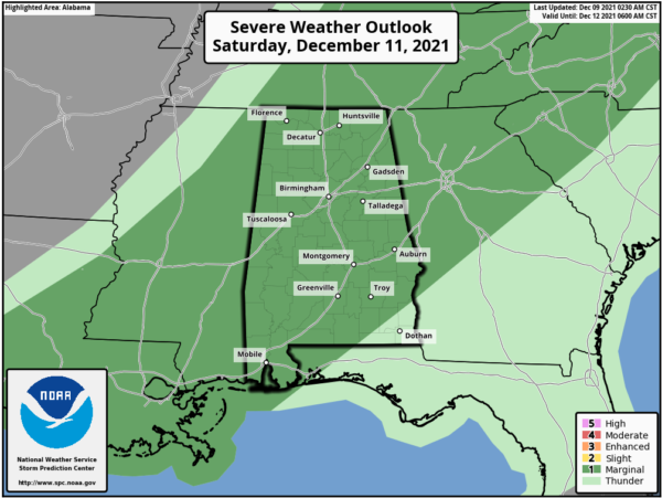
STORMY START TO THE WEEKEND: Showers and storms northwest of Alabama will evolve into a long line after midnight tomorrow night, and will move into Alabama early Saturday morning. SPC has defined a “slight risk” (level 2/5) as far east as Athens, Haleyville, and Millport for the early morning hours Saturday, and a “marginal risk” (level 1/5) for the rest of the state during the day.
TIMING: The line of strong to severe storms will likely enter the northwest corner of Alabama around 4:00-5:00 a.m. Saturday. The line should reach the Birmingham/Anniston/Gadsden/Tuscaloosa areas around 11:00 a.m.-12:00 noon. Then, after 12 noon the line will be south of I-20, pushing into the southern counties by mid to late afternoon. The severe weather threat will is not as great for South Alabama as dynamic support will be weakening by then.
THREATS: For Alabama, the main threat will come from strong, potentially damaging straight line winds. A few isolated tornadoes can’t be ruled out, however. Rain will be briefly heavy, but flooding is not expected.
CALL TO ACTION: Be sure you have a way of hearing severe weather warnings. Your primary source should NEVER be an outdoor siren. Have a NOAA Weather Radio in your home properly programmed with a fresh battery in case of power failure. Be sure emergency alerts are enabled on your phone. And, review your severe weather plan; identify the safe place and be sure everyone knows where it is. And, if you live in a mobile home, know where you will go in case you fall in a tornado warning polygon.
Temperatures will go the wrong way Saturday. We start the day in the 67-72 degree range, but after the line of storms temperatures will fall into the 50s with a cool northwest wind. The sky will clear Saturday night.
Sunday will be a sunny, cool day with a high in the 55-60 degree range.
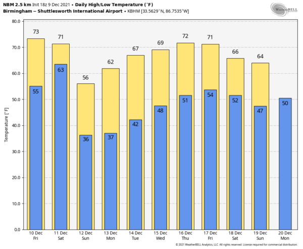
NEXT WEEK: The week will be dry and pleasant thanks to an upper high forming over the Gulf Coast region. Highs will be in the 60s Monday through Wednesday… and close to 70 Thursday and Friday. And, the latest CPC outlook suggests temperatures will remain above average across Alabama December 17-23. See the Weather Xtreme video for maps, graphics, and more details.
ON THIS DATE IN 2003: Although it never threatened land, a subtropical storm became Tropical Storm Peter approx. 700 miles WNW of the Cape Verde Islands. Combined with Tropical Storm Odette from earlier in the month, this is the first time since 1887 that two tropical storms formed in the Atlantic Basin in December.
BEACH FORECAST: Click here to see the AlabamaWx Beach Forecast Center page.
WEATHER BRAINS: Don’t forget you can listen to our weekly 90 minute show anytime on your favorite podcast app. This is the show all about weather featuring many familiar voices, including our meteorologists here at ABC 33/40.
CONNECT: You can find me on all of the major social networks…
Look for the next Weather Xtreme video here by 6:00 a.m. tomorrow…
Category: Alabama's Weather, ALL POSTS, Weather Xtreme Videos


