Midday Nowcast: Clouds on the Increase
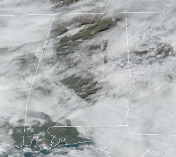
It was a cold start to the day, but temperatures are warming up under a mix of sun and clouds. Clouds will be increasing later today and overnight as a warm begins to lift north from the Gulf Coast. Highs today will be in the 60s. Not as cold tonight, due to the increasing clouds, and some showers are likely late tonight across the state as the front moves through; a rumble of thunder is possible, no severe storms are expected. Tomorrow will be much warmer as temperatures surge into the mid and upper 70s with a gusty southerly breeze. Passing showers will remain possible at time tomorrow with a partly sunny sky.
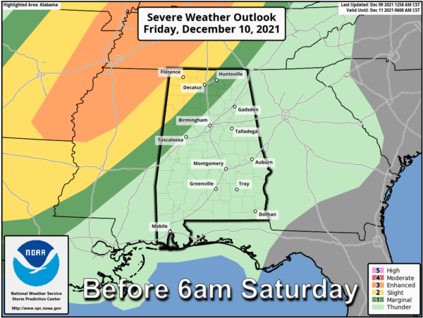
WATCHING STORMS: Tomorrow will be a stormy day for areas northwest of Alabama across the Mid-South. The SPC has issued an “enhanced risk” (level 3/5) for severe thunderstorms in these areas tomorrow, including cities like Memphis and Nashville. Up that way, a strong tornado can’t be ruled out there during the afternoon and evening hours. This activity will evolve into a long line of strong to severe thunderstorms that will push into Alabama during the early morning hours Saturday.
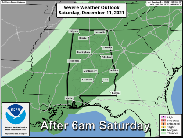
As the line arrives into Northwest Alabama, the SPC has defined a “slight risk” (level 2/5) as far east as Athens, Haleyville, and Millport for the early morning hours Saturday. For the rest of Saturday, the SPC has covered most of Alabama in a “marginal risk” (level 1/5). This could certainly be upgraded before the event, but still the main dynamics with the system will be pulling away from Alabama.
STORMY SATURDAY: The line will continue to drop south and east through Alabama during the morning hours, likely reaching the Birmingham/Anniston/Gadsden/Tuscaloosa areas just before Noon. After noon, the line will be south of I-20, pushing into the southern counties by mid to late afternoon.
THREATS: For Alabama, the main threat will come from strong, potentially damaging straight line winds. A few isolated tornadoes can’t be ruled out, however. Rain will be briefly heavy, but flooding is not expected as rainfall totals should be in the ½ – 1 inch range.
BEACH FORECAST CENTER: Get the latest weather and rip current forecasts for the beaches from Fort Morgan to Panama City on our Beach Forecast Center page. There, you can select the forecast of the region that you are interested in visiting.
WORLD TEMPERATURE EXTREMES: Over the last 24 hours, the highest observation outside the U.S. was 108.9F at Marble Bar, Australia. The lowest observation was -78.0F at Delyankir, Russia.
CONTIGUOUS TEMPERATURE EXTREMES: Over the last 24 hours, the highest observation was 88F at Sebring, FL. The lowest observation was -9F at Estcourt Station, ME.
WEATHER ON THIS DATE IN 1917: A severe winter storm struck the Ohio Valley and the Great Lakes Region. It produced 25 inches of snow and wind gusts to 78 mph at Buffalo NY. The storm produced 26 inches of snow at Vevay IND, with drifts fourteen feet high. By the 16th of the month people could walk across the frozen Ohio River from Vavey into Kentucky.
Category: Alabama's Weather, ALL POSTS


