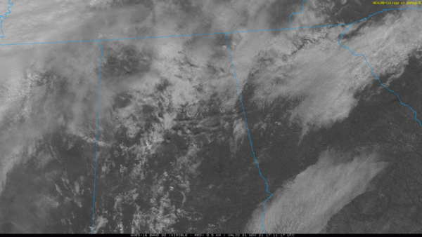
Alabama Update: 11:15 a.m. Sunday
Let’s update the forecast on this beautiful late fall Sunday in Alabama.
Clouds are definitely increasing across the state ahead of our next weather-maker, a frontal system that will cross the state tonight and tomorrow morning.
At 11 a.m., the front is through Fayetteville, Arkansas. A surface low is located along the front over southwestern Arkansas. The low will drive southeast and southward, passing into South Alabama tonight.
11 a.m. temperatures across North and Central Alabama are in the 60s where it has been sunny, and in the 50s where it has been cloudier. 70s are prevalent over South Alabama. Highs this afternoon will be in the lower to middle 60s across North and North Central Alabama in places like Albertville, Double Springs, and Scottsboro. Middle to upper 60s will be prevalent across much of the rest of Central Alabama, with readings near 70F from Montgomery to the south.
A shield of rain will reach Northwest Alabama by 4 p.m. It will reach the I-59 Corridor by 10 p.m. Expect about 3-4 hours of rain, with some heavy rain at the outset. Rainfall amounts will average between one quarter and one-half inch with a few heavier amounts mainly over Northwest Alabama.
There could be some isolated pockets of thunder, but no severe weather with the rain.
Dewpoints will fall behind the front, which will reach Montgomery around 9 a.m. By morning, temperatures will be in the 40s over Northwest Alabama, to near 50F along I-20. Readings will remain steady or rise only a degree or two during the day with cold air advection occurring. That despite full sunshine returning during the day. Expect a widespread freeze Monday night, the coldest night of the week. Readings will range between 27-33 degrees across the area.
Category: Alabama's Weather, ALL POSTS


