What About Wanda?
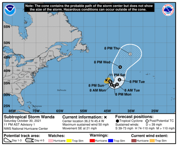
Subtropical Storm Wanda has formed tonight over the northern Atlantic and the NHC has initiated advisories.
The non-tropical low that the NHC has been monitoring has completed the transformation to subtropical status tonight. There are some signs that the system has become tropical , but the more overwhelming evidence says subtropical. Winds are 50 mph.
It is moving ESE at 20 mph. That general direction will be maintained for the next day or but the forward speed will decrease. Wanda will meander about tomorrow before turning sharply to the north or northeast by the middle of the week.
Wanda will likely maintain its strength during the next several days. Although the system will remain over relatively cool waters of about 23-24 C during the next couple of days, cold air aloft should aid in the continued development of deep convection and could allow the system to strengthen slightly during that time period. Beyond that time, Wanda should begin to move over cooler waters and that will likely end its opportunity to gain strength and lead to post-tropical transition by the end of the forecast period.


