Core of Category 4 Hurricane Sam Now East-Southeast of Bermuda
SUMMARY OF 800 PM AST…0000 UTC…INFORMATION
———————————————-
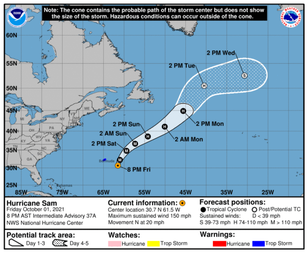
LOCATION…30.7N 61.5W
ABOUT 215 MI…345 KM ESE OF BERMUDA
MAXIMUM SUSTAINED WINDS…150 MPH…240 KM/H
PRESENT MOVEMENT…N OR 5 DEGREES AT 20 MPH…31 KM/H
MINIMUM CENTRAL PRESSURE…937 MB…27.67 INCHES
WATCHES AND WARNINGS
——————–
A Tropical Storm Warning is in effect for…
* Bermuda
DISCUSSION AND OUTLOOK
———————-
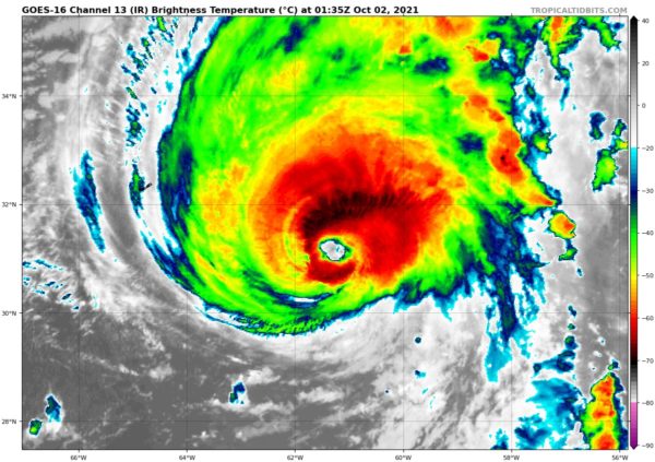
At 800 PM AST (0000 UTC), the eye of Hurricane Sam was located near latitude 30.7 North, longitude 61.5 West. Sam is moving just east of due north near 20 mph (31 km/h). A turn toward the north-northeast, at a slightly slower forward speed, is expected tonight, followed by a northeastward motion Saturday night through Monday. On the forecast track, the center of Sam will pass well to the east of Bermuda tonight.
Maximum sustained winds are near 150 mph (240 km/h) with higher gusts. Sam is a category 4 hurricane on the Saffir-Simpson Hurricane Wind Scale. Although fluctuations in intensity are still possible, weakening is forecast during the next couple of days. However, Sam is expected to remain a major hurricane through at least Saturday night.
Hurricane-force winds extend outward up to 60 miles (95 km) from the center, and tropical-storm-force winds extend outward up to 205 miles (335 km). The estimated minimum central pressure is 937 mb (27.67 inches).
HAZARDS AFFECTING LAND
———————-
WIND: Tropical storm conditions are possible on Bermuda beginning tonight or early Saturday.
SURF: Swells generated by Sam will impact the northern Leeward Islands, the Greater Antilles, the Bahamas, and Bermuda during the next couple of days. Swells are expected to reach the United States east coast and Atlantic Canada on Saturday. These swells could cause life-threatening surf and rip current conditions. Please consult products from your local weather office.
Category: ALL POSTS, Severe Weather, Tropical


