Saturday Weather Xtreme: Sunny Skies for the Weekend
THIS WEEKEND: Today will be an absolute wonderful day across Central Alabama with mainly sunny skies and warm, but a comfortable warm as we continue to have lower humidity values. Highs will be in the mid to upper 80s. No weather issues for Alabama, Auburn, and UAB today as all three games will be played in nearly-complete sunshine with temperatures in the 80s.
While we will continue with mainly sunny skies on Sunday, it will be a little warmer. Humidity values will be on the rise as tropical air from the disturbance moving up from the southern Gulf of Mexico will begin to invade Central Alabama. Highs in the upper 80s to the lower 90s.
THE WORK WEEK AHEAD: With the more humid air in place over the area on Monday, we’ll return to having a chance of isolated to scattered afternoon showers and storms. Skies will start off mostly sunny, but clouds will build with the heating of the day. Highs in the mid 80s to the lower 90s. Same story for Tuesday and again on Wednesday… a mix of sun and clouds, with isolated to scattered showers and storms becoming possible by the afternoon. Highs in the mid to upper 80s.
On Thursday, the tropical moisture that has mostly stayed to our west will get a slight push eastward and that will bring an increase to our scattered shower and thunderstorm chances throughout the day, with most of the activity occurring during the main heating of the day. Highs in the mid to upper 80s. Scattered showers and storms continue to be possible for much of the day on Friday, with much of the activity occurring during the afternoon hours. Highs in the mid to upper 80s.
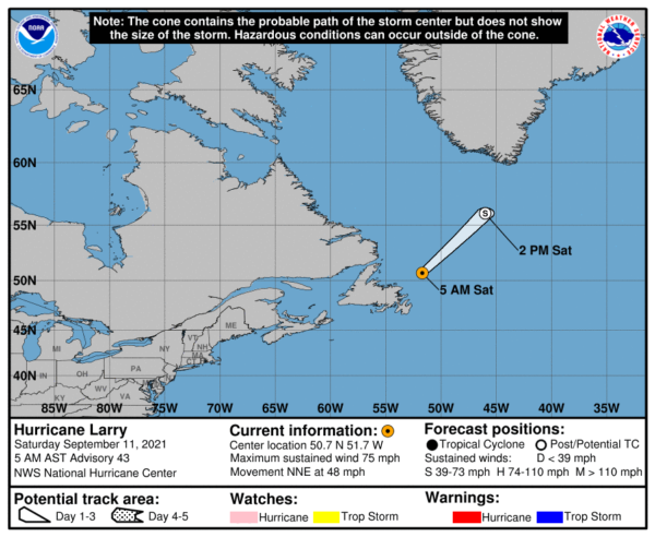
THE TROPICS: Hurricane Larry will become a post-tropical cyclone later today as it is racing away from Newfoundland and will continue to move out to sea.
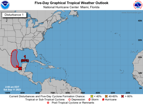
Invest 94L continues to produce disorganized showers and thunderstorms over portions of Central America, southeastern Mexico, and the adjacent waters of the northwestern Caribbean Sea and southern Gulf of Mexico. Conditions are expected to become more conducive for development over the weekend, and a tropical depression is likely to form on Sunday or Monday while the system moves northwestward and then northward near the coast of northeastern Mexico. If it remains over the water, further development will be possible through the middle of next week. Heavy rain will likely reach portions of the western Gulf coast, including coastal Texas and Louisiana, through the middle of next week.
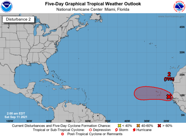
We also have Invest 93L on the board, which is a tropical wave is producing showers and thunderstorms between Senegal and the Cabo Verde Islands. Conditions are conducive for additional development, and a tropical depression is likely to form late this weekend or early next week while the system moves generally westward near the Cabo Verde Islands. Way too early to know if it will recurve or continue westward toward the US mainland.
Category: Alabama's Weather, ALL POSTS, Tropical, Weather Xtreme Videos


