A Very Busy Time Out There in the Tropics
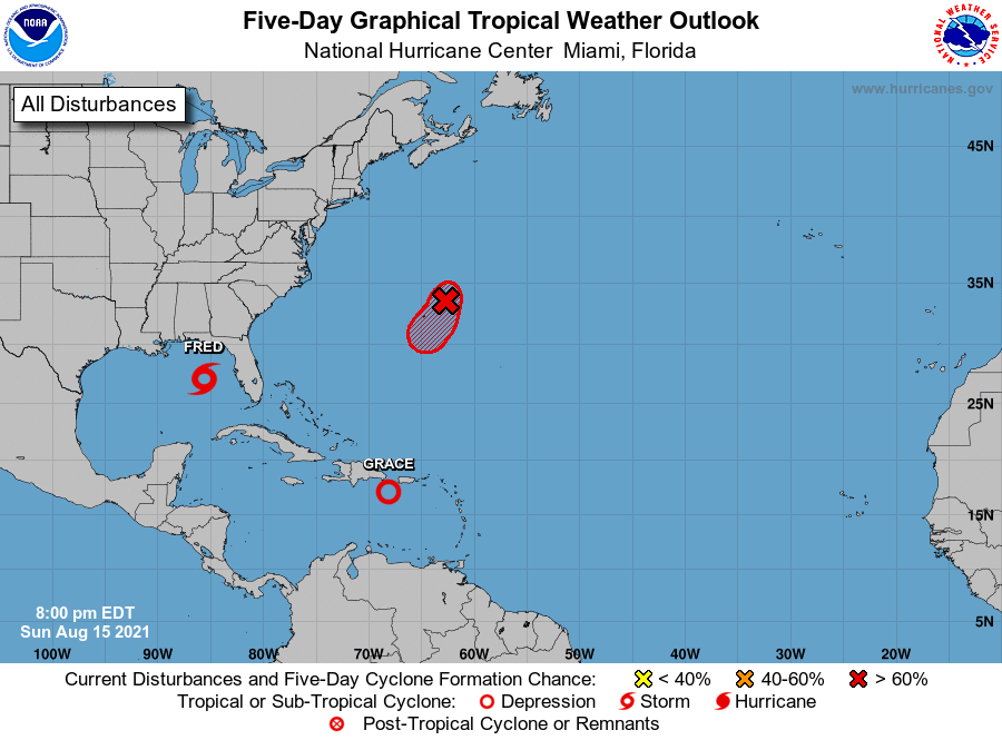
It is a very busy time for the tropics as we have two named systems out there on the board, along with a potential third system that could become a tropical depression later tonight or early Monday northeast of Bermuda. Here is the latest from the National Hurricane Center on Invest 96L:
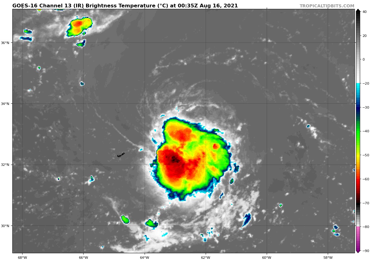
Satellite imagery and radar data from Bermuda indicate that showers and thunderstorms associated with a small, but well-defined area of low pressure located northeast of Bermuda have continued to become better organized during the past few hours. If this trend continues, advisories will likely be initiated on a new tropical depression later tonight. The system is forecast to move slowly toward the south or southwest during the next day or so, and then turn westward on Tuesday, passing near or just east and south of Bermuda. Interests in Bermuda should monitor the progress of this system, and a Tropical Storm Watch could be required for that island tonight.
* Formation chance through 48 hours…high…90 percent.
* Formation chance through 5 days…high…90 percent.
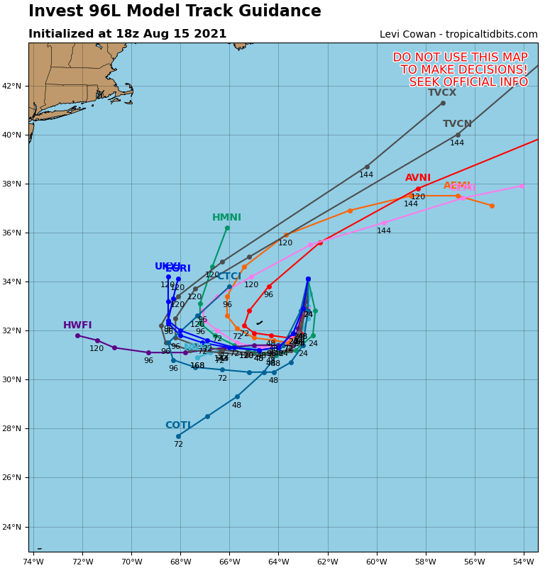
If this disturbance does become a tropical storm, it will garner the name of Henri. The latest model track guidance has 96L making a loop out in the Atlantic Ocean and moving back off to the northeast and will be no threat to the continental US. Nearly every member of the model intensity guidance has 96L staying as a weaker tropical storm or as a depression. There is only one outlier that wants to ramp it up to a category 2 hurricane. If it all plays out as the consensus of the members are showing, we will not have to worry about this disturbance.
Now let’s focus on the tropical storm that will impact the southeastern US… Fred…
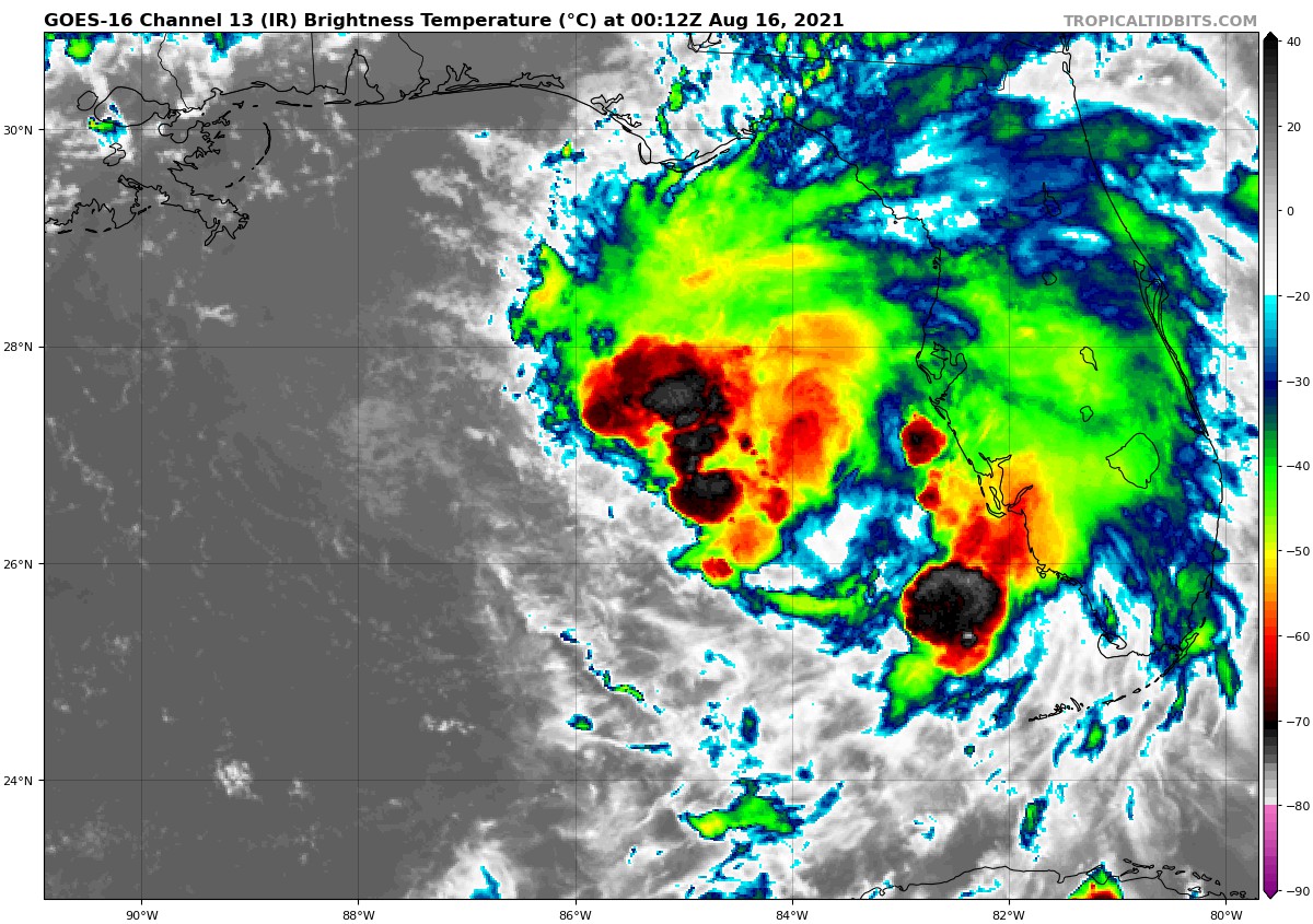
Fred has become a better organized storm throughout the day today, and the latest satellite image shows that the low-level circulation has become better defined, with a good core of convection around the center. However, much of the activity remains on the eastern half of the storm. There will be some strengthening between now and landfall, which is expected to take place on Monday night around or near Rosemary Beach on the Florida panhandle, with maximum sustained winds around 60-65 mph and gusts as high as 70-75 mph. The Center of Fred will eventually trek across the eastern parts of Central Alabama during the early morning hours through the early afternoon hours on Tuesday.
Fred’s Impacts on Central Alabama:
If Fred continues to moves into and across Central Alabama with the same formation as nearly all of the activity is located on the eastern half of the storm, there is a good possibility that the western half of the area could see very little activity, while locations along and east of I-59 in the northern half of the area, and east of I-65 in the southern half, could see greater impacts.
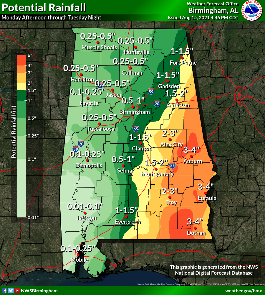
Rainfall amounts from Fred look to range from less than 1/4-inch in the west and southwestern parts of the area, to as high as 3-4 inches in the east and southeastern parts, with the potential of slightly higher localized amounts. The good news is that widespread flooding is not expected, but don’t be surprised if there are one or two issues with ponding or minor street flooding.
It will be breezy across much of the area from Monday night through Tuesday afternoon, but winds should not be a large factor for the western parts of the area (wind gusts of 20 mph or less). For locations that will be along and east of the path of the circulation center of Fred, wind gusts may reach as high as 35-40 mph, especially south of I-85 on Monday night and into Tuesday morning.
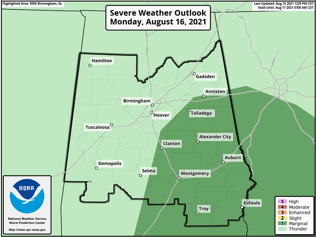
For now, there is a low-end threat for a few brief spin-up tropical-type tornadoes across the eastern and southeastern parts of the area from Monday night through Tuesday morning. The Storm Prediction Center has included locations along and east of a line from just east of Selma to Columbiana to Anniston in a level 1/5 Marginal Risk for severe storms for that threat of tornadoes. For now, there is no severe threat outlined for Tuesday.
We’ll have frequent updates throughout the next two days on Fred’s impacts across the state and down on the Gulf Coast.
Now, here’s the latest on Tropical Depression Grace…
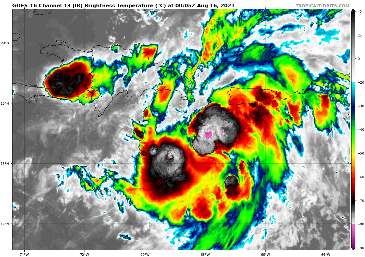
While there is plenty of convection involved with Grace, her circulation has become elongated and winds have dropped to 35 mph. However, there is the potential for Grace to restrengthen for a little while tonight and into the early morning hours on Monday, before moving over land. After that, Grace will continue on a west-northwestward path across the Gulf of Mexico, staying well south of the Alabama Gulf Coast, and eventually approaching the Texas and Mexico coast. It is expected to be a mid-level tropical storm with 50 mph winds on Friday afternoon as of the latest NHC update. Most of the model intensity members keep Grace as a tropical storm until landfall, with that occurring somewhere between Houston, Texas and Tampico, Mexico.
Category: Alabama's Weather, ALL POSTS, Severe Weather, Tropical
About the Author (Author Profile)
Scott Martin is an operational meteorologist, professional graphic artist, musician, husband, and father. Not only is Scott a member of the National Weather Association, but he is also the Central Alabama Chapter of the NWA president. Scott is also the co-founder of Racecast Weather, which provides forecasts for many racing series across the USA. He also supplies forecasts for the BassMaster Elite Series events including the BassMaster Classic.Subscribe
If you enjoyed this article, subscribe to receive more just like it.


