Sun, Heat, Scattered Afternoon Storms
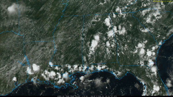
RADAR CHECK: We have the usual array of random, scattered showers and thunderstorms across Alabama this afternoon. Stronger storms are producing heavy rain and lots of lightning… they are moving to the east and will gradually end tonight after sunset. Away from the showers, temperatures are mostly in the low 90s; the average high for Birmingham on August 9 is 91.
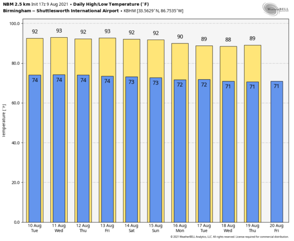
REST OF THE WEEK: A flat upper ridge will stay in place, and the weather just won’t change much through Friday. Partly sunny days, highs in the low 90s, and the daily round of scattered showers and thunderstorms, mostly between 1:00 and 10:00 p.m. Chance of any one spot getting wet each day will be in the 30-40 percent range, and highs will remain in the low 90s, right at seasonal averages.
THE ALABAMA WEEKEND: We will stick with a persistence forecast. Partly sunny Saturday and Sunday with highs at or just over 90 degrees, and “scattered, mostly afternoon and evening showers and thunderstorms”. No way of knowing in advance exactly when and where they pop up if you have something planned outdoors… you just have to watch radar trends.
NEXT WEEK: There is a little uncertainty early in the week; a tropical system could be in the Northeast Gulf of Mexico, but there is no way to resolve the location, timing, and intensity now IF anything forms. For most of the week the routine summer weather pattern continues… See the Weather Xtreme video for maps, graphics, and more details.
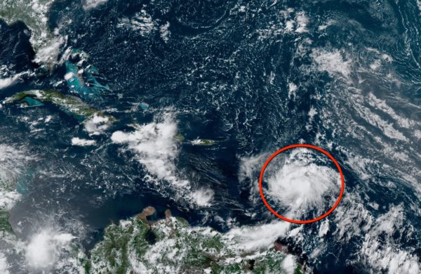
TROPICS: The attention is on Invest 94L in the Atlantic, about 100 miles east-northeast of Barbados. It continue to show signs of organization. However, recent satellite wind data indicates that the system currently lacks a well-defined center. Environmental conditions are expected to remain conducive for additional development, and a tropical depression is likely to form later today or tonight while the low moves west-northwestward at 10 to 15 mph. The disturbance is forecast to move through portions of the Lesser Antilles tonight, then move near the Virgin Islands and Puerto Rico tomorrow, and Hispaniola on Wednesday. Tropical storm watches or warnings could be required this afternoon with shorter-than-normal lead times for portions of the Lesser Antilles, the Virgin Islands, and Puerto Rico. In addition, heavy rains and flooding are likely for the Leeward Islands, Virgin Islands, and Puerto Rico.
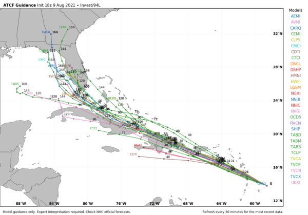
Models bring the system across Hispaniola and the northern coast of Cuba. This interaction with land, along with dry air, will limit potential intensification. IF the system survives, it could wind up in the Southeast Gulf of Mexico in 5-6 days. Too early to know if there will be any impact to the U.S. If the system becomes a tropical storm, the name will be Fred.
The rest of the Atlantic basin, including the Gulf of Mexico, is quiet.
ON THIS DATE IN 1969: An F3 tornado hit Cincinnati, Ohio, killing four persons and causing fifteen million dollars property damage. The tornado moved in a southeasterly direction at 40 to 50 mph.
BEACH FORECAST: Click here to see the AlabamaWx Beach Forecast Center page.
WEATHER BRAINS: Don’t forget you can listen to our weekly 90 minute show anytime on your favorite podcast app. This is the show all about weather featuring many familiar voices, including our meteorologists here at ABC 33/40.
CONNECT: You can find me on all of the major social networks…
Look for the next Weather Xtreme video here by 6:00 a.m. tomorrow…
Category: Alabama's Weather, ALL POSTS, Weather Xtreme Videos


